1
Whitchurch Village Practice, Cardiff
Located on Park Road (A4054), close to Whitchurch Hospital and Velindre Hospital.
Image: © Jaggery
Taken: 19 Feb 2010
0.02 miles
2
Park Road (A4054) - Whitchurch
The section of road leading north-west out of Cardiff to the M4 .
Image: © Mick Lobb
Taken: 9 Apr 2010
0.04 miles
3
Main entrance to Whitchurch Hospital, Cardiff
This is main entrance to the hospital and car park from the busy A4054 road the leads to Junction 32 M4 motorway.
Image: © Martyn Harries
Taken: 15 Sep 2009
0.06 miles
4
Entrance to Whitchurch hospital
Image: © Gareth James
Taken: 31 Jul 2010
0.06 miles
5
Whitchurch Hospital
Opened in 1908 and named the Cardiff City Mental Hospital, it was renamed Whitchurch Hospital in 1948 and on being renamed Whitchurch Hospital in 1974 became the centre for psychiatric services of South Glamorgan Health Authority. The hospital also served as the Welsh Metropolitan War Hospital from 1915 to 1919 and as the Cardiff Royal Infirmary War Emergency Hospital from 1940 to 1945.
Image: © Mick Lobb
Taken: 8 Apr 2010
0.06 miles
6
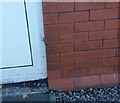
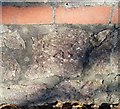
Ordnance Survey Cut Mark
This OS cut mark can be found on the Hospital Lodge. It marks a point 39.167m above mean sea level.
Image: © Adrian Dust
Taken: 18 Nov 2018
0.06 miles
7
Entrance lodge, Whitchurch Hospital, Cardiff
Viewed from Park Road (A4054).
Image: © Jaggery
Taken: 19 Feb 2010
0.08 miles
8
Whitchurch Convenience Store, Cardiff
Formerly the site of a post office, the store is located at the corner of Park Road and Park Crescent.
http://www.geograph.org.uk/photo/1715571 to a closeup of the Edward VII postbox.
Image: © Jaggery
Taken: 19 Feb 2010
0.08 miles
9
Edward VII postbox, Whitchurch
Located next to Whitchurch Convenience Store, http://www.geograph.org.uk/photo/1715578 formerly a post office, on the corner of Park Road and Park Crescent.
Image: © Jaggery
Taken: 19 Feb 2010
0.08 miles
10
Ordnance Survey Cut Mark
This OS cut mark can be found on the wall of No52 Park Road. It marks a point 38.161m above mean sea level.
Image: © Adrian Dust
Taken: 18 Nov 2018
0.08 miles


