
IMAGES TAKEN NEAR TO
Park Lane, CARDIFF, CF14 7BB
Introduction
This page details the photographs taken nearby to Park Lane, CF14 7BB by members of the Geograph project.
The Geograph project started in 2005 with the aim of publishing, organising and preserving representative images for every square kilometre of Great Britain, Ireland and the Isle of Man.

There are currently over 7.5m images from over14,400 individuals and you can help contribute to the project by visiting https://www.geograph.org.uk
Image Map
Images are licensed for reuse under creativecommons.org/licenses/by-sa/2.0
Notes
- Clicking on the map will re-center to the selected point.
- The higher the marker number, the further away the image location is from the centre of the postcode.
Image Listing (113 Images Found)
Images are licensed for reuse under creativecommons.org/licenses/by-sa/2.0
Image
Details
Distance
1
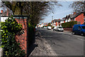
Park Road (A4054) - Whitchurch
The section of road leading north-west out of Cardiff to the M4 .
Image: © Mick Lobb
Taken: 9 Apr 2010
0.05 miles
2
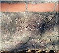
Ordnance Survey Cut Mark
This OS cut mark can be found on the wall of No52 Park Road. It marks a point 38.161m above mean sea level.
Image: © Adrian Dust
Taken: 18 Nov 2018
0.08 miles
3
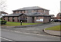
Whitchurch Village Practice, Cardiff
Located on Park Road (A4054), close to Whitchurch Hospital and Velindre Hospital.
Image: © Jaggery
Taken: 19 Feb 2010
0.08 miles
4
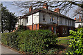
Red brick and white paint - Whitchurch
These buildings, appearing to be houses, are associated with the nearby hospital complex. Outwardly impressive to look at they show signs of 'occupied dereliction'.
Image: © Mick Lobb
Taken: 9 Apr 2010
0.08 miles
5
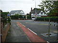
Main entrance to Whitchurch Hospital, Cardiff
This is main entrance to the hospital and car park from the busy A4054 road the leads to Junction 32 M4 motorway.
Image: © Martyn Harries
Taken: 15 Sep 2009
0.09 miles
7
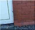
Ordnance Survey Cut Mark
This OS cut mark can be found on the Hospital Lodge. It marks a point 39.167m above mean sea level.
Image: © Adrian Dust
Taken: 18 Nov 2018
0.09 miles
9
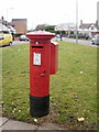
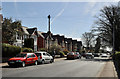
Edward VII postbox, Whitchurch
Located next to Whitchurch Convenience Store, http://www.geograph.org.uk/photo/1715578 formerly a post office, on the corner of Park Road and Park Crescent.
Image: © Jaggery
Taken: 19 Feb 2010
0.11 miles
10
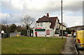
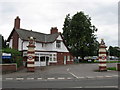
Whitchurch Convenience Store, Cardiff
Formerly the site of a post office, the store is located at the corner of Park Road and Park Crescent.
http://www.geograph.org.uk/photo/1715571 to a closeup of the Edward VII postbox.
Image: © Jaggery
Taken: 19 Feb 2010
0.11 miles