
IMAGES TAKEN NEAR TO
Heol Gwyndaf, CARDIFF, CF14 5QB
Introduction
This page details the photographs taken nearby to Heol Gwyndaf, CF14 5QB by members of the Geograph project.
The Geograph project started in 2005 with the aim of publishing, organising and preserving representative images for every square kilometre of Great Britain, Ireland and the Isle of Man.

There are currently over 7.5m images from over14,400 individuals and you can help contribute to the project by visiting https://www.geograph.org.uk
Image Map
Images are licensed for reuse under creativecommons.org/licenses/by-sa/2.0
Notes
- Clicking on the map will re-center to the selected point.
- The higher the marker number, the further away the image location is from the centre of the postcode.
Image Listing (20 Images Found)
Images are licensed for reuse under creativecommons.org/licenses/by-sa/2.0
Image
Details
Distance
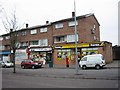
2
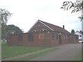
Llanishen Evangelical Church, Cardiff
In 1953 an evangelist Stan Ford held a gospel campaign in a large tent where the church now stands. The tent remained on the site after this, and a Sunday School and other meetings were held in it until it blew down in a gale. In 1954 a metal hut, dismantled from a site in Bedlinog, was erected here and a church was commenced, its opening service being on Sat. 15th May. The present brick-built chapel was opened on 7th March 1959, and an extension added in 1976. The church was originally called Llanishen Gospel Hall, then Emmaus Chapel, before the present name.
Image: © John Lord
Taken: 26 Aug 2008
0.08 miles
3
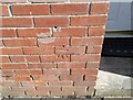
Ordnance Survey Cut Mark
This OS cut mark can be found on No152 Fishguard Road. It marks a point 39.776m above mean sea level.
Image: © Adrian Dust
Taken: 26 Feb 2024
0.11 miles
4
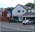
Llanishen Garage, Cardiff
Located at 83 Fidlas Road. Services advertised on the sign are MoT test centre, servicing, engine diagnostics, welding.
Image: © Jaggery
Taken: 23 Aug 2010
0.13 miles
5
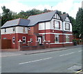
Cardiff : Fidlas Road houses north of Ewenny Road
Houses on the west side of the road, viewed from the corner of Ewenny Road. http://www.geograph.org.uk/photo/2030339
Image: © Jaggery
Taken: 23 Aug 2010
0.15 miles
6
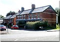
Wyndham Terrace, Cardiff
Viewed across Fidlas Road. A railway bridge http://www.geograph.org.uk/photo/1909539 is a few metres beyond the left edge of the photo.
Image: © Jaggery
Taken: 23 Aug 2010
0.15 miles
7
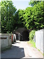
Footpath leading to railway underpass, Llanishen
Image: © Gareth James
Taken: 12 Jun 2010
0.16 miles
8
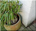
Ordnance Survey Cut Mark
This OS cut mark can be found on No269 Fishguard Road. It marks a point 42.285m above mean sea level.
Image: © Adrian Dust
Taken: 26 Feb 2024
0.17 miles
9
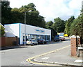
Cardiff : Two sided garage, Llanishen (1)
Alpha & Yapps garage located adjacent to a sharp bend in Fidlas Road under a railway bridge. http://www.geograph.org.uk/photo/1909539
This is the western part of the premises, viewed from the corner of Usk Road.
http://www.geograph.org.uk/photo/2030891 to the eastern part on the opposite side of the road.
The garage is both a car salesroom and servicing and repair centre.
Image: © Jaggery
Taken: 23 Aug 2010
0.19 miles
10
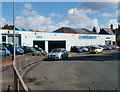
Cardiff : Two sided garage, Llanishen (2)
Alpha & Yapps garage located adjacent to a sharp bend in Fidlas Road under a railway bridge. http://www.geograph.org.uk/photo/1909539
This is the eastern part of the premises, viewed from the edge of the bridge.
http://www.geograph.org.uk/photo/2030881 to the western part on the opposite side of the road.
The garage is both a car salesroom and servicing and repair centre.
Image: © Jaggery
Taken: 23 Aug 2010
0.19 miles