1
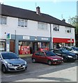
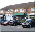
Demolition of The Orchards at Llanishen
Image: © Gareth James
Taken: 1 Aug 2017
0.04 miles
2
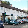
Llanishen Library, Cardiff
Located between a branch of Lloyds TSB http://www.geograph.org.uk/photo/2031113 and Ladbrokes. Part of Cardiff Council library service, this library is a part-time branch, open 19.5 hours per week.
Image: © Jaggery
Taken: 23 Aug 2010
0.04 miles
3
Lloyds TSB, Llanishen, Cardiff
Bank branch at 29 Kimberley Terrace.
Image: © Jaggery
Taken: 23 Aug 2010
0.04 miles
4
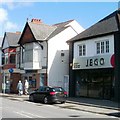
Barclays, Llanishen, Cardiff
Bank branch at 34 Station Road, opposite St Isan's church. Next door is Jego hair salon.
Image: © Jaggery
Taken: 23 Aug 2010
0.04 miles
5
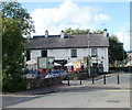
The Church Inn, Llanishen, Cardiff
Located at the north end of Kimberley Terrace, at the junction with Station Road and Ty Glas Road.
Image: © Jaggery
Taken: 23 Aug 2010
0.08 miles
6
St Isan's church, Llanishen
Llanishen takes its name from the church (Welsh Llanisien llan church + Isien Saint Isan).
The church building is in the English style. It was formed from the original Norman church, with the addition of a tower in the 15th century. Major work in 1908 created the present-day appearance of the church building.
Image: © Jaggery
Taken: 23 Aug 2010
0.10 miles
7
Llanishen Post Office, Cardiff
Located at 15 Station Road, between St Isan's church http://www.geograph.org.uk/photo/2031103 and the police station.
Image: © Jaggery
Taken: 23 Aug 2010
0.10 miles
8
Ordnance Survey Cut Mark
This OS cut mark can be found on No269 Fishguard Road. It marks a point 42.285m above mean sea level.
Image: © Adrian Dust
Taken: 26 Feb 2024
0.11 miles
9
NatWest, Llanishen, Cardiff
Bank branch at 50 Station Road, next door to a Co-operative Food store.
Image: © Jaggery
Taken: 23 Aug 2010
0.11 miles
10
Government offices, Llanishen, Cardiff
Government tax office at Parc-Ty-Glas, Cardiff.
Image: © Steve Chapple
Taken: 6 Sep 2005
0.11 miles


