1
Birchgrove railway station, Cardiff
Birchgrove railway station, Cardiff
Image: © Steve Chapple
Taken: 20 Aug 2005
0.06 miles
2
Birchgrove Surgery, Cardiff
On the corner of Caerphilly Road and Phoenix Way.
Birchgrove Surgery was first established in the 1920s. The main surgery moved to its present location in August 2005. There is also a branch surgery in Rhiwbina Clinic.
The practice is currently a partnership of 5 GPs.
Image: © Jaggery
Taken: 19 Feb 2010
0.08 miles
3
Corner of Phoenix Way and Caerphilly Road, Birchgrove, Cardiff
Caerphilly Road is at the bottom of the photo.
Image: © Jaggery
Taken: 19 Feb 2010
0.08 miles
4
Co-operative Pharmacy, Birchgrove, Cardiff
Adjoining Birchgrove Surgery http://www.geograph.org.uk/photo/1716226 on the corner of Caerphilly Road and Phoenix Way.
Image: © Jaggery
Taken: 19 Feb 2010
0.08 miles
5
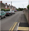
Phoenix Way, Cardiff
On the west side of the A469 Caerphilly Road.
Image: © Jaggery
Taken: 21 Jun 2016
0.09 miles
6
Birchgrove Allotments, Cardiff
Image: © John Lord
Taken: 26 Aug 2008
0.10 miles
7
Dryburgh Avenue, Cardiff
Cul-de-sac on the west side of the A469 Caerphilly Road.
Dryburgh Avenue ends at an allotments perimeter fence ahead.
Image: © Jaggery
Taken: 21 Jun 2016
0.10 miles
8
Site for a new Aldi store, Caerphilly Rd, Cardiff
The site, a former petrol station and other buildings, has lain derelict for many years. It is now being developed as an Aldi store. Given that there is a recently enlarged Lidl about 100 yards away, a Tesco Express about 250 yards away, a Morrisons about 400 yards away, and a Coop about 400 yards in the opposite direction, and given the desperate need for more housing, it is hard to see why planning permission was given.
Image: © John Lord
Taken: 26 Mar 2018
0.11 miles
9
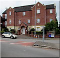
Phoenix Way Apartments, Cardiff
Viewed from the corner of Caerphilly Road. The nameplate at the entrance
shows that the apartments are numbered from 2 to 18 (even numbers only).
Image: © Jaggery
Taken: 21 Jun 2016
0.11 miles
10
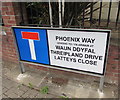
Three unique street names, Cardiff
The sign is on the right here, http://www.geograph.org.uk/photo/5005898
According to one online source, the Cardiff streets named Waun Ddyfal, Threipland Drive and Latteys Close are the only examples of these names in the UK. There are more than a dozen streets named Phoenix Way in the UK.
Image: © Jaggery
Taken: 21 Jun 2016
0.12 miles


