1
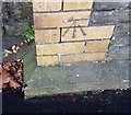
Corner of Heath Park Avenue and Highfield Road, Cardiff
The turning for Highfield Road on the right marks the northern end of Allensbank Road and the southern end of Heath Park Avenue.
Image: © Jaggery
Taken: 23 Aug 2010
0.03 miles
2
Highfields Day Centre, Cardiff
Located on Allensbank Road near the Highfield Road turning, this is a purpose-built centre for people with physical disabilities.
Image: © Jaggery
Taken: 23 Aug 2010
0.05 miles
3
King George V Drive East, Cardiff
Looking south. On the right is Heath Park.
Image: © Jaggery
Taken: 2 Oct 2009
0.06 miles
4
Heath Citizens Association building, Cardiff
This building is part of the Heath Citizens Association premises, set back a few metres from the main hall. http://www.geograph.org.uk/photo/1668819
Image: © Jaggery
Taken: 2 Oct 2009
0.06 miles
5
Heath Citizens Association Hall, Cardiff
Adjacent to King George V Drive East. Among the many groups and societies using the hall are
Cardiff Scrabble Club
Cardiff Quilters
Cyncoed Floral Group
Honto Judo
India Dance Wales
Infocus Camera Club
Word of Life Fellowship Yoga
The Citizens Association also use a second hall http://www.geograph.org.uk/photo/1746096 a few metres behind this one.
Image: © Jaggery
Taken: 2 Oct 2009
0.06 miles
6
Ordnance Survey Cut Mark
This OS cut mark can be found on the house at the corner of Highfield Road. It marks a point 40.929m above mean sea level.
Image: © Adrian Dust
Taken: 19 Nov 2017
0.07 miles
7
Golf course, Heath Park
The pitch and putt 9 hole golf course observed in steady rain from beneath trees.
Image: © Derek Harper
Taken: 16 Jun 2018
0.07 miles
8
Ordnance Survey Cut Mark
This OS cut mark can be found on the gatepost at the entrance to No16 Allensbank Road. It marks a point 35.162m above mean sea level.
Image: © Adrian Dust
Taken: 19 Nov 2017
0.08 miles
9
Weak bridge 170 yards ahead, Highfield Road, Cardiff
At the western end of Highfield Road, a blue sign advises that a weak bridge ahead http://www.geograph.org.uk/photo/2028993 has a 3 tonne maximum weight limit.
Image: © Jaggery
Taken: 23 Aug 2010
0.09 miles
10
Lane behind the houses
Back lane for the houses on King George V Drive and Allensbank Road.
Image: © Eirian Evans
Taken: 17 Jul 2010
0.09 miles


