IMAGES TAKEN NEAR TO
King George V Drive North, CARDIFF, CF14 4EH

Introduction

This page details the photographs taken nearby to King George V Drive North, CF14 4EH by members of the Geograph project.

The Geograph project started in 2005 with the aim of publishing, organising and preserving representative images for every square kilometre of Great Britain, Ireland and the Isle of Man.

There are currently over 7.5m images from over14,400 individuals and you can help contribute to the project by visiting https://www.geograph.org.uk

Image Map


Images are licensed for reuse under creativecommons.org/licenses/by-sa/2.0
Notes
  • Clicking on the map will re-center to the selected point.
  • The higher the marker number, the further away the image location is from the centre of the postcode.

Image Listing (148 Images Found)

Images are licensed for reuse under creativecommons.org/licenses/by-sa/2.0
  • ...
Image
Details
Distance
1
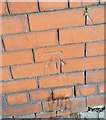
Ordnance Survey Cut Mark
This OS cut mark can be found on the wall of No189 Heathwood Road. It marks a point 38.076m above mean sea level.
Image: © Adrian Dust Taken: 18 Nov 2018
0.05 miles
2
Heath playing fields and King George V Drive North.
Image: © Gareth James Taken: 12 Jun 2010
0.06 miles
3
Ordnance Survey Cut Mark
This OS cut mark can be found on the wall of No165 Heathwood Road. It marks a point 39.959m above mean sea level.
Image: © Adrian Dust Taken: 18 Nov 2018
0.11 miles
4
Ordnance Survey Cut Mark
This OS cut mark can be found on No7 Maes Y Coed Road. It marks a point 40.612m above mean sea level.
Image: © Adrian Dust Taken: 18 Nov 2018
0.11 miles
5
Houses, King George V Drive North, Cardiff
Houses viewed across a rugby pitch in King George Fields, Heath Park.
Image: © Jaggery Taken: 2 Oct 2009
0.12 miles
6
Ordnance Survey Cut Mark
This OS cut mark can be found on the wall post NE side of Heathwood Road. It marks a point 38.076m above mean sea level.
Image: © Adrian Dust Taken: 18 Nov 2018
0.13 miles
7
St Gildas Rd, Heath, Cardiff
Image: © John Lord Taken: 2 May 2010
0.14 miles
8
Cathays RFC pavilion, Heath Park, Cardiff
There are two signs on the front of the building. On the first is "Cathays R.F.C" (rugby football club) Below it, a sign states "CATHAYS HIGH SCHOOL THESE PLAYING FIELDS AND PAVILION ARE FOR THE USE OF CATHAYS HIGH SCHOOL AND OTHER AUTHORISED PERSONS ONLY"
Image: © Jaggery Taken: 2 Oct 2009
0.15 miles
9
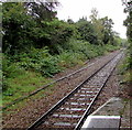
Coryton Line from Heath Low Level towards Ty Glas, Cardiff
Viewed from the single platform at Heath Low Level. http://www.geograph.org.uk/photo/4835174 The next station ahead is Ty Glas. http://www.geograph.org.uk/photo/1148804
Image: © Jaggery Taken: 28 Jan 2016
0.16 miles
10
Coryton Line NNW from Heath Low Level station, Cardiff
Next station ahead is Ty Glas on the route to the branch line's terminus at Coryton.
Image: © Jaggery Taken: 4 Oct 2019
0.16 miles
  • ...