1
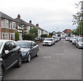
East along Lon-y-groes, Cardiff
Extending from the A470 Merthyr Road to the A469 Caerphilly Road (ahead).
Image: © Jaggery
Taken: 21 Jun 2016
0.06 miles
2
Footpath behind St Angela Rd, from its junction with St Agnes Rd, Cardiff
Image: © John Lord
Taken: 8 Jul 2012
0.08 miles
3
Cardiff : Caerphilly Road approaches North Road
To the right of the Aneurin Bevan, http://www.geograph.org.uk/photo/1715892 Caerphilly Road, heading south towards the camera, becomes North Road. Merthyr Road merges with North Road on the far side of the Aneurin Bevan.
Image: © Jaggery
Taken: 2 Oct 2009
0.08 miles
4
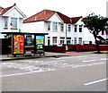
Adverts on a Caerphilly Road bus shelter, Cardiff
This is a Clear Channel advertising site.
Image: © Jaggery
Taken: 21 Jun 2016
0.08 miles
5
Side view of the Eastern Manor, Cardiff
At the date of this photo, October 2009, this large building on the corner of Caerphilly Road and Merthyr Road was the Eastern Manor restaurant. Less than two months later, it opened for business as the Aneurin Bevan pub. http://www.geograph.org.uk/photo/1715892
Image: © Jaggery
Taken: 2 Oct 2009
0.08 miles
6
The Aneurin Bevan, Cardiff
Located on the corner of Caerphilly Road and Merthyr Road, at the north end of the Gabalfa flyover.
A Wetherspoon pub, the Aneurin Bevan opened on November 20 2009.
Some locals questioned the choice of name. Aneurin (Nye) Bevan http://www.geograph.org.uk/photo/836619 was a famous Welsh politician who had a major role in the establishment of the NHS (National Health Service). But he was born in Tredegar, Monmouthshire, and didn't have much of a connection with Cardiff.
Image: © Jaggery
Taken: 19 Feb 2010
0.08 miles
7
Rhydhelig Avenue, Cardiff
Houses on the north side of the avenue, viewed from the Caerphilly Road end.
Image: © Jaggery
Taken: 2 Oct 2009
0.09 miles
8
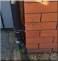
Ordnance Survey Cut Mark
This OS cut mark can be found on No35 Caerphilly Road. It marks a point 32.202m above mean sea level.
Image: © Adrian Dust
Taken: 18 Nov 2018
0.09 miles
9
Merthyr Road semis, Cardiff
Semi-detached houses viewed across the A470 Merthyr Road from the corner of Lon-y-groes.
Image: © Jaggery
Taken: 21 Jun 2016
0.11 miles
10
The New Inn, Birchgrove, Cardiff
Pub at 67 Caerphilly Road, on the corner of Hampton Road. Once known as The Chequers.
Image: © Jaggery
Taken: 19 Feb 2010
0.12 miles


