1
Cardiff : Caerphilly Road approaches North Road
To the right of the Aneurin Bevan, http://www.geograph.org.uk/photo/1715892 Caerphilly Road, heading south towards the camera, becomes North Road. Merthyr Road merges with North Road on the far side of the Aneurin Bevan.
Image: © Jaggery
Taken: 2 Oct 2009
0.03 miles
2
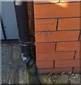
Ordnance Survey Cut Mark
This OS cut mark can be found on No35 Caerphilly Road. It marks a point 32.202m above mean sea level.
Image: © Adrian Dust
Taken: 18 Nov 2018
0.04 miles
3
Lon-y-Groes, Cardiff
Houses on the north side of Lon-y-Groes, a short road connecting Merthyr Road and Caerphilly Road. The empty shop on the corner was formerly occupied by Brandon Tool Hire.
Image: © Jaggery
Taken: 2 Oct 2009
0.04 miles
4
The New Inn, Birchgrove, Cardiff
Pub at 67 Caerphilly Road, on the corner of Hampton Road. Once known as The Chequers.
Image: © Jaggery
Taken: 19 Feb 2010
0.04 miles
5
Merthyr Road semis, Cardiff
Semi-detached houses viewed across the A470 Merthyr Road from the corner of Lon-y-groes.
Image: © Jaggery
Taken: 21 Jun 2016
0.05 miles
6
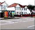
Adverts on a Caerphilly Road bus shelter, Cardiff
This is a Clear Channel advertising site.
Image: © Jaggery
Taken: 21 Jun 2016
0.05 miles
7
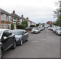
East along Lon-y-groes, Cardiff
Extending from the A470 Merthyr Road to the A469 Caerphilly Road (ahead).
Image: © Jaggery
Taken: 21 Jun 2016
0.06 miles
8
Valley Vets, Cardiff
At 180 Merthyr Road.
Image: © Jaggery
Taken: 21 Jun 2016
0.06 miles
9
D W Morgan & Sons shop in Hampton Road, Cardiff
Shoe repairs and key cutting business.
Image: © Jaggery
Taken: 21 Jun 2016
0.08 miles
10
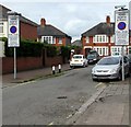
Hampton Road Controlled Zone signs, Cardiff
The parking controlled zone signs are on the west side of the A469 Caerphilly Road.
Hampton Road leads to Norton Avenue.
Image: © Jaggery
Taken: 21 Jun 2016
0.08 miles


