
IMAGES TAKEN NEAR TO
Llanishen Street, CARDIFF, CF14 3QD
Introduction
This page details the photographs taken nearby to Llanishen Street, CF14 3QD by members of the Geograph project.
The Geograph project started in 2005 with the aim of publishing, organising and preserving representative images for every square kilometre of Great Britain, Ireland and the Isle of Man.

There are currently over 7.5m images from over14,400 individuals and you can help contribute to the project by visiting https://www.geograph.org.uk
Image Map
Images are licensed for reuse under creativecommons.org/licenses/by-sa/2.0
Notes
- Clicking on the map will re-center to the selected point.
- The higher the marker number, the further away the image location is from the centre of the postcode.
Image Listing (62 Images Found)
Images are licensed for reuse under creativecommons.org/licenses/by-sa/2.0
Image
Details
Distance
1
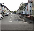
Edington Avenue, Cardiff
Looking towards Llanishen Street from Clodien Avenue.
Image: © Jaggery
Taken: 3 Sep 2009
0.03 miles
2
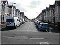
Summerfield Avenue, Cardiff
Viewed from Clodien Avenue looking towards Llanishen Street.
Image: © Jaggery
Taken: 3 Sep 2009
0.04 miles
3
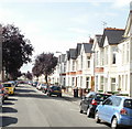
Clodien Avenue, Cardiff
Houses on the north side of the avenue, between Summerfield Avenue and Edington Avenue.
Image: © Jaggery
Taken: 3 Sep 2009
0.07 miles
4
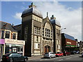
Heath Evangelical Church, Cardiff
Viewed across Whitchurch Road, between Llanishen Street and Manor Street.
The Church was founded in 1901 by the Reverend John Pugh. The building was opened on June 20th 1906.
Image: © Jaggery
Taken: 3 Sep 2009
0.07 miles
5
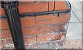
Ordnance Survey Cut Mark
This OS cut mark can be found on No11 Whitchurch Road. It marks a point 30.306m above mean sea level.
Image: © Adrian Dust
Taken: 16 Mar 2018
0.07 miles
6
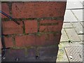
Ordnance Survey Cut Mark
This OS cut mark can be found on No114 Whitchurch Road. It marks a point 29.489m above mean sea level.
Image: © Adrian Dust
Taken: 16 Mar 2018
0.07 miles
7
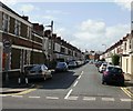
Manor Street, Cardiff
Manor Street heads away from Allensbank Road towards Whitchurch Road.
Image: © Jaggery
Taken: 3 Sep 2009
0.07 miles
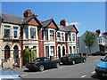
9
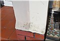
Ordnance Survey Cut Mark
This OS cut mark can be found on No15 Soberton Avenue. It marks a point 30.422m above mean sea level.
Image: © Adrian Dust
Taken: 16 Mar 2018
0.08 miles
10
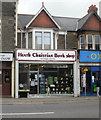
Heath Christian Book Shop, Cardiff
31 Whitchurch Road, next to St Joseph's Catholic Sports & Social Club. http://www.geograph.org.uk/photo/1808903
Bookshop and tea room affiliated with Heath Evangelical Church. http://www.geograph.org.uk/photo/1471710
Image: © Jaggery
Taken: 14 Apr 2010
0.09 miles