IMAGES TAKEN NEAR TO
Mynachdy Road, CARDIFF, CF14 3DZ

Introduction

This page details the photographs taken nearby to Mynachdy Road, CF14 3DZ by members of the Geograph project.

The Geograph project started in 2005 with the aim of publishing, organising and preserving representative images for every square kilometre of Great Britain, Ireland and the Isle of Man.

There are currently over 7.5m images from over14,400 individuals and you can help contribute to the project by visiting https://www.geograph.org.uk

Image Map


Images are licensed for reuse under creativecommons.org/licenses/by-sa/2.0
Notes
  • Clicking on the map will re-center to the selected point.
  • The higher the marker number, the further away the image location is from the centre of the postcode.

Image Listing (72 Images Found)

Images are licensed for reuse under creativecommons.org/licenses/by-sa/2.0
  • ...
Image
Details
Distance
1
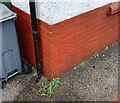
Ordnance Survey Cut Mark
This OS cut mark can be found on No25 Mynachdy Road. It marks a point 22.141m above mean sea level.
Image: © Adrian Dust Taken: 4 Mar 2024
0.03 miles
2
House construction, Pen-y-Bryn Way, Cardiff
Houses under construction at the end of August 2009, viewed from the corner of North Road.
Image: © Jaggery Taken: 28 Aug 2009
0.04 miles
3
Gabalfa Baptist Church, Cardiff
Built in 1884. The church is located on the corner of North Road and Newfoundland Road. On the left is the church hall.
Image: © Jaggery Taken: 28 Aug 2009
0.04 miles
4
Mynachdy Road, Cardiff
Looking northwestwards from near the North Road end.
Image: © Jaggery Taken: 28 Aug 2009
0.05 miles
5
Ordnance Survey Cut Mark
This OS cut mark can be found on the old Sunday School, North Road. It marks a point 29.663m above mean sea level.
Image: © Adrian Dust Taken: 16 Mar 2018
0.07 miles
6
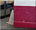
Ordnance Survey Cut Mark
This OS cut mark can be found on No61 Mynachdy Road. It marks a point 19.032m above mean sea level.
Image: © Adrian Dust Taken: 4 Mar 2024
0.08 miles
7
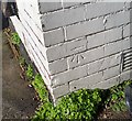
Ordnance Survey Cut Mark
This OS cut mark can be found on No207 North Road. It marks a point 28.895m above mean sea level.
Image: © Adrian Dust Taken: 16 Mar 2018
0.08 miles
8
Ordnance Survey Cut Mark
This OS cut mark can be found on No157 North Road. It marks a point 27.203m above mean sea level.
Image: © Adrian Dust Taken: 16 Mar 2018
0.09 miles
9
Talybont North - University campus
Image: © Fernweh Taken: 23 Sep 2022
0.11 miles
10
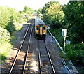
Train for Barry Island in suburban Cardiff
Viewed from this bridge. http://www.geograph.org.uk/photo/3057092 The train is heading for Barry Island via Cardiff Queen Street and Cardiff Central (and several other) stations.
Image: © Jaggery Taken: 28 Jul 2012
0.12 miles
  • ...