1
Ordnance Survey Cut Mark
This OS cut mark can be found on the wall NW side of Velindre Road. It marks a point 37.094m above mean sea level.
Image: © Adrian Dust
Taken: 18 Nov 2018
0.03 miles
2
Tredegar Court, Whitchurch, Cardiff
Cul-de-sac on the west side of the road named Heol Don.
Image: © Jaggery
Taken: 10 Aug 2017
0.10 miles
3
West along Heol Mathew, Whitchurch, Cardiff
From Heol Don along Heol Mathew towards Heol Chappell.
Image: © Jaggery
Taken: 10 Aug 2017
0.11 miles
4
Whitchurch Hospital, Cardiff
Combined water tower and chimney with power house complex at the bottom. There were two Belliss and Morcom steam engine generator sets here but on this visit we found the dismantled in the yard. Sad!
Image: © Chris Allen
Taken: 15 Aug 1987
0.11 miles
5
Heol Don Cottage, Whitchurch, Cardiff
On the corner of Heol Don (this side) and Velindre Road.
Image: © Jaggery
Taken: 10 Aug 2017
0.12 miles
6
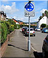
Mini-roundabout 80 yards/llath, Heol Don, Whitchurch, Cardiff
The English/Welsh sign faces northbound traffic on Heol Don
80 yards from this http://www.geograph.org.uk/photo/5492385 mini-roundabout at the Velindre Road junction.
Image: © Jaggery
Taken: 10 Aug 2017
0.12 miles
7
Mini roundabout and cottage - Whitchurch
The junction of Heol Don and Velindre Road.
Image: © Mick Lobb
Taken: 15 Apr 2010
0.12 miles
8
Mini-roundabout in the middle of a T-junction, Whitchurch, Cardiff
At the junction of Heol Don and Velindre Road.
Image: © Jaggery
Taken: 10 Aug 2017
0.12 miles
9
Cardiff High School Old Boys
Rugby ground for Cardiff High School Old Boys near to Forest Farm.
Image: © Steve Chapple
Taken: 5 Sep 2005
0.13 miles
10
Protest flags in Cardiff's Northern Meadows
These meadows are under threat of development.
Image: © Gareth James
Taken: 31 Dec 2020
0.13 miles


