
IMAGES TAKEN NEAR TO
Chamberlain Road, CARDIFF, CF14 2LW
Introduction
This page details the photographs taken nearby to Chamberlain Road, CF14 2LW by members of the Geograph project.
The Geograph project started in 2005 with the aim of publishing, organising and preserving representative images for every square kilometre of Great Britain, Ireland and the Isle of Man.

There are currently over 7.5m images from over14,400 individuals and you can help contribute to the project by visiting https://www.geograph.org.uk
Image Map
Images are licensed for reuse under creativecommons.org/licenses/by-sa/2.0
Notes
- Clicking on the map will re-center to the selected point.
- The higher the marker number, the further away the image location is from the centre of the postcode.
Image Listing (143 Images Found)
Images are licensed for reuse under creativecommons.org/licenses/by-sa/2.0
Image
Details
Distance
1
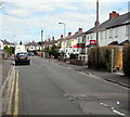
Chamberlain Road, Llandaff North, Cardiff
On the NE side of the A4054 Station Road.
Image: © Jaggery
Taken: 18 Apr 2016
0.03 miles
2
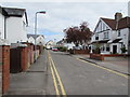
Maplewood Avenue, Llandaff North, Cardiff
Viewed across Station Road looking along Maplewood Avenue towards Durlston Close.
Image: © Jaggery
Taken: 18 Apr 2016
0.03 miles
3
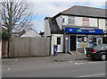
Bobby's Shop, Llandaff North, Cardiff
Lifestyle Express convenience store at 30 Station Road.
Image: © Jaggery
Taken: 18 Apr 2016
0.07 miles
4
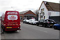
Clark's Pies van in Llandaff North, Cardiff
Making a pie delivery to Bobby's Shop http://www.geograph.org.uk/photo/4915961 at 30 Station Road. Clark's Pies, nicknamed Clarkies or Clarksies, are meat pies made in Cardiff. The exact recipe of the pie filling is a closely-guarded secret. Each pie has CLARPIE stamped into the pastry.The first Clark's Pies were made by Mary Clark in 1913.
Image: © Jaggery
Taken: 18 Apr 2016
0.08 miles
5
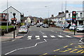
Station Road, Llandaff North, Cardiff
Looking NNW along the A4054 Station Road in mid April 2016 when the
zebra crossing on a hump is newly installed. Black covers remain on the Belisha beacon globes.
Image: © Jaggery
Taken: 18 Apr 2016
0.08 miles
6
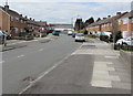
Clarbeston Road, Llandaff North, Cardiff
Viewed from near the corner of Gabalfa Avenue.
Image: © Jaggery
Taken: 18 Apr 2016
0.08 miles
7
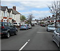
Hilton Place, Llandaff North, Cardiff
From Station Road towards Chamberlain Road.
Image: © Jaggery
Taken: 18 Apr 2016
0.09 miles
8
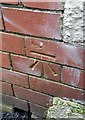
Ordnance Survey Cut Mark
This OS cut mark can be found on The Pineapple Inn, Station Road. It marks a point 20.690m above mean sea level.
Image: © Adrian Dust
Taken: 28 Oct 2019
0.09 miles
9
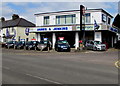
James & Jenkins, Llandaff North, Cardiff
Car sales and vehicle hire business viewed across the A4054 Station Road.
Image: © Jaggery
Taken: 18 Apr 2016
0.09 miles
10
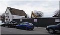
Station Road demolition site, Llandaff North, Cardiff
In mid April 2016, a Bond Demolition machine is at work in the former James & Jenkins garage site.
The business has relocated to the opposite side of the road. http://www.geograph.org.uk/photo/4917506
Image: © Jaggery
Taken: 18 Apr 2016
0.09 miles