1
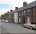
Long row of houses, Ty Mawr Road, Llandaff North, Cardiff
Extending eastwards from the corner of Pommergelli Road. http://www.geograph.org.uk/photo/4921518
Image: © Jaggery
Taken: 18 Apr 2016
0.01 miles
2
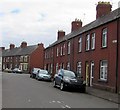
Cars and houses, Ty Mawr Road, Llandaff North, Cardiff
The gap in the houses is at the Pommergelli Road junction. http://www.geograph.org.uk/photo/4921518
Image: © Jaggery
Taken: 18 Apr 2016
0.02 miles
3
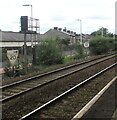
Row of houses above Ty Mawr Road, Llandaff North, Cardiff
The backs of the houses face railway lines near Llandaf railway station.
Image: © Jaggery
Taken: 18 Apr 2016
0.02 miles
4
Railway from Llandaf station towards Radyr station, Cardiff
Though this area of Cardiff is known in English as Llandaff North, the station name
uses only the Welsh spelling Llandaf. Radyr station is about a mile (c1.6km) ahead.
Image: © Jaggery
Taken: 18 Apr 2016
0.03 miles
5
Roberts Villas, Ty Mawr Road, Llandaff North, Cardiff
Separately named and numbered (1 to 6) houses on the north side of Ty Mawr Road.
Image: © Jaggery
Taken: 18 Apr 2016
0.04 miles
6
Pommergelli Road, Llandaff North, Cardiff
Towards Ty Mawr Road from West Road.
Image: © Jaggery
Taken: 18 Apr 2016
0.04 miles
7
Railway speed limit signs, Llandaff North, Cardiff
Viewed from Llandaf station. Although this area is Llandaff North in English, the station has the Welsh-only name Llandaf. https://www.geograph.org.uk/photo/6898241
Image: © Jaggery
Taken: 9 Jul 2021
0.04 miles
8
South along Pommergelli Road, Llandaff North, Cardiff
From Ty Mawr Road towards West Road.
Image: © Jaggery
Taken: 18 Apr 2016
0.04 miles
9
Llandaf Railway Station looking west
The next station in this direction is Radyr. Further away, the route divides just north of Pontypridd into the Merthyr line and Rhondda line.
http://www.geograph.org.uk/photo/1694399 to the view east.
Image: © Jaggery
Taken: 5 Feb 2010
0.05 miles
10
West Road electricity substation, Llandaff North, Cardiff
Western Power Distribution electricity substation located on the left here. http://www.geograph.org.uk/photo/4912989
Its identifier is WEST RD LLANDAFF NORTH S/S 511614.
Image: © Jaggery
Taken: 18 Apr 2016
0.05 miles


