1
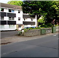
Heol Don Court, Whitchurch, Cardiff
Flats set back from the west side of the A4054 Heol Don.
Image: © Jaggery
Taken: 10 Aug 2017
0.00 miles
2
Ordnance Survey Cut Mark
This OS cut mark can be found on the wall of Benton House. It marks a point 30.593m above mean sea level.
Image: © Adrian Dust
Taken: 28 Oct 2019
0.01 miles
3
Telecoms cabinets near Heol Don Court, Whitchurch, Cardiff
Viewed across the A4054 Heol Don. A Virgin Media cabinet and
a BT cabinet are alongside the perimeter wall of Heol Don Court. http://www.geograph.org.uk/photo/5492315
Image: © Jaggery
Taken: 10 Aug 2017
0.02 miles
4
Western end of Church Road, Whitchurch, Cardiff
Viewed across the A4054 Heol Don. Near a Virgin Media van, an engineer is working at a telecoms cabinet.
Image: © Jaggery
Taken: 10 Aug 2017
0.04 miles
5
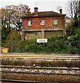
Derelict building above Llandaf railway station, Cardiff
The building on the south side of The Parade looks long derelict in October 2017. Small trees are in the chimneys.
Image: © Jaggery
Taken: 31 Oct 2017
0.04 miles
6
Platform canopy work underway at Llandaf station
At this time, it is not clear whether the remaining section of the old canopy is being renovated or removed, but the scaffolding present and care taken suggests it might just be the former.
Image: © Gareth James
Taken: 26 Aug 2022
0.04 miles
7
Disused station building at Llandaff
Image: © Gareth James
Taken: 6 Aug 2017
0.04 miles
8
Disused station building at Llandaff
Image: © Gareth James
Taken: 6 Aug 2017
0.04 miles
9
Llandaff Station from the footbridge
Image: © John Lord
Taken: 4 Feb 2009
0.05 miles
10
Ordnance Survey Flush Bracket (G3710)
This OS Flush Bracket can be found on the west parapet of the Railway Bridge, Station Road. It marks a point 29.455m above mean sea level.
Image: © Adrian Dust
Taken: 28 Oct 2019
0.05 miles


