IMAGES TAKEN NEAR TO
Heol Iestyn, CARDIFF, CF14 1QE
Introduction
This page details the photographs taken nearby to Heol Iestyn, CF14 1QE by members of the Geograph project.
The Geograph project started in 2005 with the aim of publishing, organising and preserving representative images for every square kilometre of Great Britain, Ireland and the Isle of Man.

There are currently over 7.5m images from over14,400 individuals and you can help contribute to the project by visiting https://www.geograph.org.uk
Image Map
Images are licensed for reuse under creativecommons.org/licenses/by-sa/2.0
Notes
- Clicking on the map will re-center to the selected point.
- The higher the marker number, the further away the image location is from the centre of the postcode.
Image Listing (29 Images Found)
Images are licensed for reuse under creativecommons.org/licenses/by-sa/2.0
Image
Details
Distance
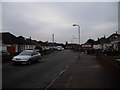
2
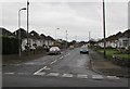
Lon-y-parc, Cardiff
From the south side of Ty'n-y-parc Road, Lon-y-parc leads to Kyle Avenue and Heol Nest.
Image: © Jaggery
Taken: 6 Nov 2019
0.14 miles
3
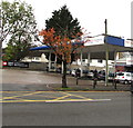
Tesco Express filling station, Ty'n-y-parc Road, Cardiff
A few metres east of the Tesco Express store. https://www.geograph.org.uk/photo/6331055
Image: © Jaggery
Taken: 6 Nov 2019
0.20 miles
4
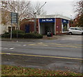
Jet Wash, Ty'n-y-parc Road, Cardiff
A few metres from this https://www.geograph.org.uk/photo/6331063 Tesco filling station.
Image: © Jaggery
Taken: 6 Nov 2019
0.20 miles
5
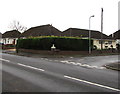
Long hedge on a suburban corner of Cardiff
On the corner of Ty'n-y-parc Road and Lon-y-parc.
Image: © Jaggery
Taken: 6 Nov 2019
0.20 miles
6
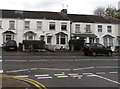
White houses, Ty'n-y-parc Road, Cardiff
Opposite the Heol-y-nant junction.
Image: © Jaggery
Taken: 6 Nov 2019
0.20 miles
7
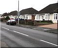
Bungalows on the south side of Ty'n-y-parc Road, Cardiff
Derived from a Hindi word meaning in the style of Bengal, bungalow was originally used in English for a lightly-built house, with a veranda and one storey. In current UK usage it is a convenient word for any one-storey dwelling.
Image: © Jaggery
Taken: 6 Nov 2019
0.20 miles
8
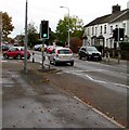
Ty'n-y-parc Road pelican crossing, Cardiff
Located between Masons Court and the Heol-y-nant junction. Chambers Dictionary states that pelican in this context is adapted from pedestrian light controlled crossing.
Image: © Jaggery
Taken: 6 Nov 2019
0.20 miles
9
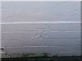
Ordnance Survey Cut Mark
This OS cut mark can be found on No29 Cae Gwyn Road. It marks a point 35.421m above mean sea level.
Image: © Adrian Dust
Taken: 18 Nov 2018
0.20 miles