IMAGES TAKEN NEAR TO
Heol Cattwg, CARDIFF, CF14 1JQ
Introduction
This page details the photographs taken nearby to Heol Cattwg, CF14 1JQ by members of the Geograph project.
The Geograph project started in 2005 with the aim of publishing, organising and preserving representative images for every square kilometre of Great Britain, Ireland and the Isle of Man.

There are currently over 7.5m images from over14,400 individuals and you can help contribute to the project by visiting https://www.geograph.org.uk
Image Map
Images are licensed for reuse under creativecommons.org/licenses/by-sa/2.0
Notes
- Clicking on the map will re-center to the selected point.
- The higher the marker number, the further away the image location is from the centre of the postcode.
Image Listing (18 Images Found)
Images are licensed for reuse under creativecommons.org/licenses/by-sa/2.0
Image
Details
Distance
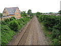
2
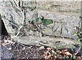
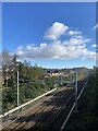
Ordnance Survey Cut Mark
This OS cut mark can be found on the NW parapet of the Railway Bridge. It marks a point 26.801m above mean sea level.
Image: © Adrian Dust
Taken: 28 Oct 2019
0.16 miles
3
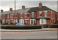
College Road, Cardiff
Viewed from Merthyr Road, Whitchurch.
Image: © Jaggery
Taken: 19 Feb 2010
0.18 miles
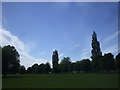
6
Whitchurch Common, Cardiff
Taken from Merthyr Road and showing College Road.
Image: © Robin Drayton
Taken: 17 Nov 2011
0.20 miles
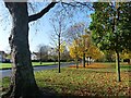
9
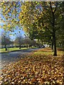
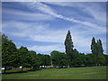
An avenue of autumn leaves on Whitchurch common
Image: © Alan Hughes
Taken: 10 Nov 2023
0.21 miles
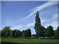
10
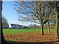
Whitchurch Common, Cardiff
Taken from Merthyr Road.
Image: © Robin Drayton
Taken: 17 Nov 2011
0.21 miles