
IMAGES TAKEN NEAR TO
The Philog, CARDIFF, CF14 1DZ
Introduction
This page details the photographs taken nearby to The Philog, CF14 1DZ by members of the Geograph project.
The Geograph project started in 2005 with the aim of publishing, organising and preserving representative images for every square kilometre of Great Britain, Ireland and the Isle of Man.

There are currently over 7.5m images from over14,400 individuals and you can help contribute to the project by visiting https://www.geograph.org.uk
Image Map
Images are licensed for reuse under creativecommons.org/licenses/by-sa/2.0
Notes
- Clicking on the map will re-center to the selected point.
- The higher the marker number, the further away the image location is from the centre of the postcode.
Image Listing (51 Images Found)
Images are licensed for reuse under creativecommons.org/licenses/by-sa/2.0
Image
Details
Distance
1
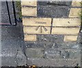
Ordnance Survey Cut Mark
This OS cut mark can be found on the gatepost of No39 The Philog. It marks a point 32.129m above mean sea level.
Image: © Adrian Dust
Taken: 18 Nov 2018
0.04 miles
2
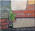
Ordnance Survey Cut Mark
This OS cut mark can be found on No134 The Philog. It marks a point 31.434m above mean sea level.
Image: © Adrian Dust
Taken: 18 Nov 2018
0.08 miles
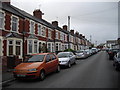
4
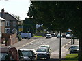
Birchgrove Road, Heath, Cardiff
The traffic lights are at the junction of Birchgrove Road and Northern Avenue.
Image: © Eirian Evans
Taken: 17 Jul 2010
0.10 miles
5
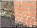
Ordnance Survey Cut Mark
This OS cut mark can be found on gatepost of No98 Birchgrove Road. It marks a point 31.510m above mean sea level.
Image: © Adrian Dust
Taken: 18 Nov 2018
0.10 miles
6
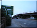
Gabalfa flyover, Cardiff
Gabalfa flyover, Mynachdy, Cardiff looking towards the city centre.
Image: © Steve Chapple
Taken: 18 Aug 2005
0.11 miles
8
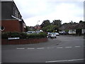
Corner of Wauntreoda Rd and Heol-y-Gors, Cardiff
Image: © John Lord
Taken: 28 May 2011
0.13 miles
9
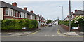
Cromwell Road, Cardiff
Dead-end road extending for 100 metres from Pantbach Road.
Image: © Jaggery
Taken: 21 Jun 2016
0.13 miles
10
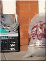
Ordnance Survey Cut Mark
This OS cut mark can be found on No60 Northern Avenue. It marks a point 34.860m above mean sea level.
Image: © Adrian Dust
Taken: 18 Nov 2018
0.13 miles