IMAGES TAKEN NEAR TO
Cherry Tree Close, CARDIFF, CF14 0TE
Introduction
This page details the photographs taken nearby to Cherry Tree Close, CF14 0TE by members of the Geograph project.
The Geograph project started in 2005 with the aim of publishing, organising and preserving representative images for every square kilometre of Great Britain, Ireland and the Isle of Man.

There are currently over 7.5m images from over14,400 individuals and you can help contribute to the project by visiting https://www.geograph.org.uk
Image Map
Images are licensed for reuse under creativecommons.org/licenses/by-sa/2.0
Notes
- Clicking on the map will re-center to the selected point.
- The higher the marker number, the further away the image location is from the centre of the postcode.
Image Listing (34 Images Found)
Images are licensed for reuse under creativecommons.org/licenses/by-sa/2.0
Image
Details
Distance
1
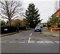
Cherry Tree Close, Lisvane, Cardiff
Cul-de-sac on the northwest side of Rowan Way.
Image: © Jaggery
Taken: 12 Jan 2018
0.01 miles
2
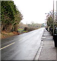
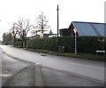
Llwyn y Pia Road, Lisvane, Cardiff
Lampposts and houses are opposite trees and hedges. The railings are alongside a public footpath.
Image: © Jaggery
Taken: 12 Jan 2018
0.06 miles
3
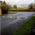
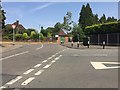
Rowan Way speed bumps, Lisvane, Cardiff
Near the Llwyn y Pia Road junction.
Image: © Jaggery
Taken: 12 Jan 2018
0.06 miles
4
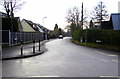
Northern end of Mill Road, Lisvane, Cardiff
Looking south along Mill Road from the eastern end of Cherry Orchard Road.
Image: © Jaggery
Taken: 12 Jan 2018
0.06 miles
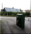
5
Dark green part of Mill Road, Lisvane, Cardiff
Dark green telecoms cabinet and dark green hedges viewed from the corner of Llwyn y Pia Road.
Image: © Jaggery
Taken: 12 Jan 2018
0.07 miles
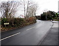
6
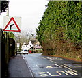
Llwyn y Pia Road speed bumps, Lisvane, Cardiff
On the approach to a bend.
Image: © Jaggery
Taken: 12 Jan 2018
0.07 miles
7
Two telecoms cabinets, Lisvane, Cardiff
The BT cabinet in the foreground is on the corner of Llwyn y Pia Road.
The Virgin Media cabinet in the background is alongside Mill Road.
Image: © Jaggery
Taken: 12 Jan 2018
0.09 miles
8
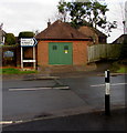
Llwyn y Pia Road electricity substation, Lisvane, Cardiff
The Western Power Distribution electricity substation is in a brick building
behind a sign showing 5 (miles) to Rudry, 3 to St Mellons (Llaneirwg in Welsh).
Image: © Jaggery
Taken: 12 Jan 2018
0.09 miles
9
Road junction
Junction of Cherry Orchard Road, Mill Lane and Llwynypia Road.
Image: © Alan Hughes
Taken: 19 Jul 2018
0.09 miles
10
Lisvane name sign, Llwyn y Pia Road, Cardiff
Lisvane (Llys-faen in Welsh) is an affluent suburb in the north of Cardiff, 8km (5 miles) from the city centre.
Image: © Jaggery
Taken: 12 Jan 2018
0.10 miles