1
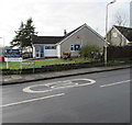
Cotswold Avenue, Lisvane, Cardiff
Long cul-de-sac on the southwset side of Llwyn y Pia Road.
Image: © Jaggery
Taken: 12 Jan 2018
0.03 miles
2
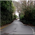
Deciduous tree between evergreen hedges, Llwyn y Pia Road, Lisvane, Cardiff
Viewed on January 12th 2018.
Image: © Jaggery
Taken: 12 Jan 2018
0.08 miles
3
Insync Pharmacy, Lisvane, Cardiff
The Llwyn y Pia Road side of the pharmacy on the corner of Heol y Delyn.
In January 2018, a notice shows Flu Vaccinations £9 - No Appointment Needed.
Image: © Jaggery
Taken: 12 Jan 2018
0.08 miles
4
Oaktree House, Lisvane, Cardiff
Distinctive house on the north side of Llwyn y Pia Road.
Image: © Jaggery
Taken: 12 Jan 2018
0.10 miles
5
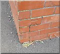
Ordnance Survey Cut Mark
This OS cut mark can be found on the south angle of the school. It marks a point 83.351m above mean sea level.
Image: © Adrian Dust
Taken: 4 Mar 2024
0.12 miles
6
T-junction in Lisvane, Cardiff
Viewed from Heol y Delyn. Left along Rudry Road for Rudry, 3 miles away.
Right along Church Road for St Mellons, also 3 miles away.
Image: © Jaggery
Taken: 12 Jan 2018
0.14 miles
7
North along Rudry Road, Lisvane, Cardiff
From the junction of Heol y Delyn and Church Road. A sign behind the camera shows Rudry 3 (miles).
Image: © Jaggery
Taken: 12 Jan 2018
0.14 miles
8
Lisvane name sign, Llwyn y Pia Road, Cardiff
Lisvane (Llys-faen in Welsh) is an affluent suburb in the north of Cardiff, 8km (5 miles) from the city centre.
Image: © Jaggery
Taken: 12 Jan 2018
0.14 miles
9
Church Road businesses, Lisvane, Cardiff
Names in view in mid January 2018 are H2O Hair Studio, Lisvane Store, Kelvin Francis Residential Sales.
Image: © Jaggery
Taken: 12 Jan 2018
0.17 miles
10
Pavementless part of Church Road, Lisvane, Cardiff
For about 100 metres, from the Heol y Delyn junction to the Cefn Mably Road junction,
there are no pavements alongside Church Road. The Parish Church of St Denys is in the background.
Image: © Jaggery
Taken: 12 Jan 2018
0.17 miles


