IMAGES TAKEN NEAR TO
Heol Nant Glandulas, CF14 0AJ

Introduction

This page details the photographs taken nearby to Heol Nant Glandulas, CF14 0AJ by members of the Geograph project.

The Geograph project started in 2005 with the aim of publishing, organising and preserving representative images for every square kilometre of Great Britain, Ireland and the Isle of Man.

There are currently over 7.5m images from over14,400 individuals and you can help contribute to the project by visiting https://www.geograph.org.uk

Image Map


Images are licensed for reuse under creativecommons.org/licenses/by-sa/2.0
Notes
  • Clicking on the map will re-center to the selected point.
  • The higher the marker number, the further away the image location is from the centre of the postcode.

Image Listing (33 Images Found)

Images are licensed for reuse under creativecommons.org/licenses/by-sa/2.0
  • ...
Image
Details
Distance
1
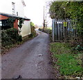
Maerdy Lane, Lisvane, Cardiff
The wooden gate https://www.geograph.org.uk/photo/5650324 on the right leads to a public footpath.
Image: © Jaggery Taken: 12 Jan 2018
0.14 miles
2
War Memorial, Lisvane
Image: © John Lord Taken: 26 Aug 2008
0.15 miles
3
House, Lisvane
Image: © John Lord Taken: 26 Aug 2008
0.15 miles
4
Looking towards Church Farm
Taken from a layby 500 metres NE of Clos Coedydafarn
Image: © Roy Douglas Taken: Unknown
0.16 miles
5
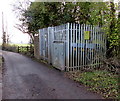
Maerdy Lane, Lisvane, Cardiff
On the southeast side of the B4562. An electricity substation https://www.geograph.org.uk/photo/5650309 is on the right.
Image: © Jaggery Taken: 12 Jan 2018
0.16 miles
6
Wooden gate to a public footpath, Maerdy Lane, Lisvane, Cardiff
The gate is about 40 metres SE of the B4562 junction behind the camera.
Image: © Jaggery Taken: 12 Jan 2018
0.16 miles
7
Maerdy Lane electricity substation, Lisvane, Cardiff
The Western Power Distribution electricity substation is a few metres from the B4562 junction.
Image: © Jaggery Taken: 12 Jan 2018
0.18 miles
8
Wales & West Utilities gas installation on a Lisvane corner, Cardiff
On the corner of Lisvane Road and Maerdy Lane, on the left here. https://www.geograph.org.uk/photo/5650630
Image: © Jaggery Taken: 12 Jan 2018
0.18 miles
9
Ordnance Survey Flush Bracket (G3992)
This OS Flush Bracket can be found on Crossways, Lisvane Road. It marks a point 70.554m above mean sea level.
Image: © Adrian Dust Taken: 4 Mar 2024
0.18 miles
10
Lisvane War Memorial, Cardiff
Lisvane War Memorial on the south side of the B4562 Lisvane Road was dedicated in 1921.
Image: © Jaggery Taken: 12 Jan 2018
0.18 miles
  • ...