
IMAGES TAKEN NEAR TO
Penarth Road, CARDIFF, CF11 8YZ
Introduction
This page details the photographs taken nearby to Penarth Road, CF11 8YZ by members of the Geograph project.
The Geograph project started in 2005 with the aim of publishing, organising and preserving representative images for every square kilometre of Great Britain, Ireland and the Isle of Man.

There are currently over 7.5m images from over14,400 individuals and you can help contribute to the project by visiting https://www.geograph.org.uk
Image Map
Images are licensed for reuse under creativecommons.org/licenses/by-sa/2.0
Notes
- Clicking on the map will re-center to the selected point.
- The higher the marker number, the further away the image location is from the centre of the postcode.
Image Listing (94 Images Found)
Images are licensed for reuse under creativecommons.org/licenses/by-sa/2.0
Image
Details
Distance
1
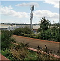
Mobile phone mast, Grangetown, Cardiff
Viewed from Grangetown railway station. The 12.7 metre high mast, owned by Orange,
has two transmitters, one transmitting at a frequency range of 1800 megahertz and the other at 2100 megahertz. Technically, these are macrocells. A macrocell provides the main coverage in a mobile network. The antennas for macrocells are mounted on ground-based masts, rooftops and other existing structures. They must be positioned at a height that is not obstructed by surrounding buildings and terrain. Macrocell base stations have a typical power output of tens of watts.
Image: © Jaggery
Taken: 5 Aug 2010
0.01 miles
2
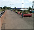
Island platform, Grangetown, Cardiff
The northbound and southbound tracks at Grangetown railway station are separated by one platform in the middle. Most 2-track railway stations have a platform on each side, with the tracks in the middle.
http://www.geograph.org.uk/photo/2047313 to a closeup view and description of the mobile phone mast at the right edge.
Image: © Jaggery
Taken: 5 Aug 2010
0.01 miles
3
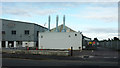
Works, Penarth Road
Looking across the A4160 to a surface coating works. On the left is a vehicle servicing garage.
Image: © Derek Harper
Taken: 15 Jun 2018
0.03 miles
4

Graffiti by the A4160
Some colour on the Penarth Road near Kismet Park.
Image: © Derek Harper
Taken: 15 Jun 2018
0.04 miles
5
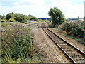
Tracks separate around island platform, Grangetown, Cardiff
The double-track railway line approaching Grangetown station from the south separates on the approach to the island platform. http://www.geograph.org.uk/photo/2071049
Image: © Jaggery
Taken: 5 Aug 2010
0.06 miles
6
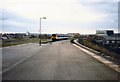
"Sprinter" Near Grangetown Station, 1988
A Class 150/2 "Sprinter" diesel multiple unit leaves Grangetown station in the spring of 1988
Image: © Rob Newman
Taken: 12 Mar 1988
0.06 miles
7
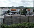
Cardiff : Halfords viewed from Grangetown railway station
The large Halfords store in located on the corner of Penarth Road (on the left) and Sloper Road.
Image: © Jaggery
Taken: 5 Aug 2010
0.07 miles
8
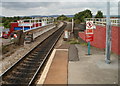
The view north from Grangetown railway station, Cardiff
Grangetown railway station is on the Vale of Glamorgan line. Little more than a kilometre ahead is Cardiff Central station.
Grangetown station has an island platform, located between two tracks. Immediately beyond the end of the platform, the track passes over a bridge across Penarth Road. A parallel bridge carries the other track across the road.
Image: © Jaggery
Taken: 5 Aug 2010
0.07 miles
9
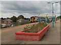
Flowerbed, shelter and train at Grangetown railway station, Cardiff
The view north along the island platform. http://www.geograph.org.uk/photo/2071049
The centre of the platform is lined with four rectangular brick structures containing flowerbeds.
Near the exit is a small shelter and seating area.
On the left, an Arriva Trains Wales service is about to depart for Bargoed. Its next stop is Cardiff Central.
Image: © Jaggery
Taken: 5 Aug 2010
0.07 miles
10
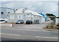
Poeton, Cardiff
Poeton Industries Ltd is a group of surface coating contracting companies which has operated since 1898. Their premises seen here are at 283 Penarth Road, Cardiff.
Image: © Jaggery
Taken: 5 Aug 2010
0.07 miles