1
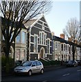
Grangetown Primary School, Cardiff
Image: © John Lord
Taken: 25 May 2010
0.06 miles
2
Bromsgrove Street with Clark's Pie shop
Image: © Colin Pyle
Taken: 3 Jan 2011
0.10 miles
3
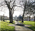
Bandstand, Grange Gardens, Cardiff
The bandstand is the focal point of Grange Gardens, a small late-Victorian park in Grangetown. The original bandstand was demolished in the 1920s. This one is a modern replica, in the same spot as the original.
Image: © Jaggery
Taken: 5 Feb 2010
0.11 miles
4
Samuel memorial, Grange Gardens, Cardiff
The view SW along the central path through the small park. In the distance is a bandstand.http://www.geograph.org.uk/photo/1972315
Near the camera is a metal structure presented to the city of Cardiff in 1908 by the Samuel brothers as a memorial to their brother, Lewin L. Samuel, who died in 1893 aged 39. There is a curious inscription on each side of the structure : KEEP THE PAVEMENT DRY. Some kind of Edwardian health and safety measure, perhaps?
Image: © Jaggery
Taken: 5 Feb 2010
0.11 miles
5
St Paul's Church, Grangetown, Cardiff
Image: © John Lord
Taken: 25 May 2010
0.13 miles
6
Bandstand in Grange Gardens
Image: © Graham Hogg
Taken: 4 Nov 2013
0.15 miles
7
Bandstand, Grange Garden, Cardiff
Image: © Ruth Sharville
Taken: 6 Dec 2013
0.15 miles
8
Ordnance Survey Cut Mark
This OS cut mark can be found on the NW face St Paul's Church. It marks a point 7.568m above mean sea level.
Image: © Adrian Dust
Taken: 1 Oct 2017
0.16 miles
9
Ordnance Survey Cut Mark
This OS cut mark can be found on the wall of No21 Avondale Road. It marks a point 8.428m above mean sea level.
Image: © Adrian Dust
Taken: 3 Feb 2019
0.16 miles
10
Ebenezer Church, Grangetown, Cardiff
The inscription around the door archway is ALL ARE WELCOME and above the 3 central windows,
1899 EBENEZER HALL. Located on Corporation Road between Taff Terrace and Abercynon Street.
Image: © Jaggery
Taken: 5 Feb 2010
0.16 miles


