
IMAGES TAKEN NEAR TO
Corporation Road, CARDIFF, CF11 7AW
Introduction
This page details the photographs taken nearby to Corporation Road, CF11 7AW by members of the Geograph project.
The Geograph project started in 2005 with the aim of publishing, organising and preserving representative images for every square kilometre of Great Britain, Ireland and the Isle of Man.

There are currently over 7.5m images from over14,400 individuals and you can help contribute to the project by visiting https://www.geograph.org.uk
Image Map
Images are licensed for reuse under creativecommons.org/licenses/by-sa/2.0
Notes
- Clicking on the map will re-center to the selected point.
- The higher the marker number, the further away the image location is from the centre of the postcode.
Image Listing (130 Images Found)
Images are licensed for reuse under creativecommons.org/licenses/by-sa/2.0
Image
Details
Distance
1
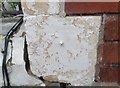
Ordnance Survey Cut Mark
This damaged OS cut mark can be found on the SE face of No71 Corporation Road. It marks a point 8.202m above mean sea level.
Image: © Adrian Dust
Taken: 1 Oct 2017
0.02 miles
2
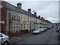
Terraced houses, Penhevad St, Cardiff
The first three houses have unusually ornate stonework above the bay windows
Image: © John Lord
Taken: 19 May 2010
0.03 miles
3
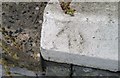
Ordnance Survey Pivot
This OS pivot can be found on the wall of No79 Pentre Bane Street. It marks a point 7.324m above mean sea level.
Image: © Adrian Dust
Taken: 1 Oct 2017
0.06 miles
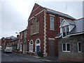
5
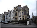
Terraced houses, Pentrebane St, Cardiff
The acute-angled junction of street and lane leaves space for a separate porch for the end house.
Image: © John Lord
Taken: 24 Feb 2011
0.06 miles
6
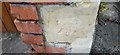
Ordnance Survey Cut Mark
This damaged OS cut mark can be found on the SE face of No21 Clydach Street. It marks a point 8.126m above mean sea level.
Image: © Adrian Dust
Taken: 1 Oct 2017
0.07 miles
7
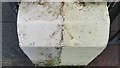
Ordnance Survey Pivot
This OS pivot can be found on the wall of No68 Stockland Street. It marks a point 7.220m above mean sea level.
Image: © Adrian Dust
Taken: 1 Oct 2017
0.07 miles
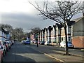
10
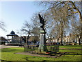
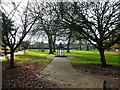
War memorial, Grange Gardens, Cardiff
A fenced-off plinth topped by an angel, in the eastern side of the park. It was erected to commemorate the men of the area who died in the Great War (1914-1918) with a tablet added to commemorate those who gave their lives in the Second World War and later conflicts.
Image: © Jaggery
Taken: 5 Feb 2010
0.08 miles