1
Ordnance Survey Pivot
This OS pivot can be found on the wall of No27 Coedcae Street. It marks a point 7.651m above mean sea level.
Image: © Adrian Dust
Taken: 1 Oct 2017
0.01 miles
2
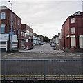
Ferndale St, Grangetown, Cardiff
Image: © John Lord
Taken: 19 May 2010
0.02 miles
3
Taffs Mead Embankment, Cardiff
The view south along the west bank of the Taff from Penarth Road bridge.
There is a cycle path between the river and the roadway.
Image: © Jaggery
Taken: 5 Aug 2010
0.05 miles
4
Grangetown houses from Taff Embankment, Cardiff
Image: © Ruth Sharville
Taken: 6 Dec 2013
0.06 miles
5
Gated alleyway at the rear of Blaenclydach St, Cardiff
Security gates recently installed.
Image: © John Lord
Taken: 24 Feb 2011
0.06 miles
6
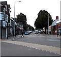
Blaenclydach Street, Grangetown, Cardiff
Viewed across the A4160 Penarth Road.
Image: © Jaggery
Taken: 14 Sep 2017
0.07 miles
7
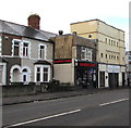
Corporation Road, Grangetown, Cardiff
Looking to the SE across a major junction in Grangetown along the A4119 Corporation Road.
Image: © Jaggery
Taken: 14 Sep 2017
0.07 miles
8
Taff Embankment
A welcome bit of green space, because there isn't much else between Bute Park and Cardiff Bay.
Image: © Bill Boaden
Taken: 31 Mar 2013
0.07 miles
9
Barber Zone, Grangetown, Cardiff
Viewed across Penarth Road in September 2017. Masjid At-Tawheed http://www.geograph.org.uk/photo/5536870 is on the right.
A March 2017 Google Earth Street View shows Yummy to Go takeaway where Barber Zone is now.
Image: © Jaggery
Taken: 14 Sep 2017
0.08 miles
10
Taff downstream from Penarth Road bridge, Cardiff
The Taff flows away from the bridge carrying Penarth Road. (A4160).
The buildings on the left are on Curran Embankment.
Image: © Jaggery
Taken: 5 Aug 2010
0.08 miles


