
IMAGES TAKEN NEAR TO
Cardiff Castle Grounds, CARDIFF, CF10 3EA
Introduction
This page details the photographs taken nearby to Cardiff Castle Grounds, CF10 3EA by members of the Geograph project.
The Geograph project started in 2005 with the aim of publishing, organising and preserving representative images for every square kilometre of Great Britain, Ireland and the Isle of Man.

There are currently over 7.5m images from over14,400 individuals and you can help contribute to the project by visiting https://www.geograph.org.uk
Image Map
Images are licensed for reuse under creativecommons.org/licenses/by-sa/2.0
Notes
- Clicking on the map will re-center to the selected point.
- The higher the marker number, the further away the image location is from the centre of the postcode.
Image Listing (35 Images Found)
Images are licensed for reuse under creativecommons.org/licenses/by-sa/2.0
Image
Details
Distance
1
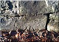
Ordnance Survey Cut Mark
This OS cut mark can be found on the wall west side of North Road. It marks a point 14.246m above mean sea level.
Image: © Adrian Dust
Taken: 27 Dec 2020
0.03 miles
2
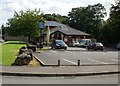
Blackweir Tavern, Cardiff
35 North Road. Built in 1988, originally named the Canal Boat.
Image: © Jaggery
Taken: 28 Aug 2009
0.06 miles
3
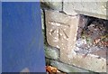
Ordnance Survey Cut Mark
This OS cut mark can be found on the NE facing wall of the school on Colum Road. It marks a point 15.127m above mean sea level.
Image: © Adrian Dust
Taken: 1 Oct 2017
0.07 miles
4
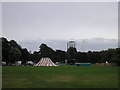
Coopers field, Cardiff
Preparations underway for the "Compass point" music festival. Just above the trees you can see the Millennium stadium.
Image: © Steve Chapple
Taken: 4 Aug 2005
0.07 miles
5
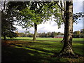
Blackweir playing fields, Bute Park, Cardiff
Image: © John Lord
Taken: 27 Oct 2010
0.07 miles
6
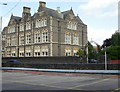
Nazareth House, Cardiff
Located on North Road.
Nazareth House was built c1847 for the third Marquis of Bute. In 1875, it became a convent for the Poor Sisters of Nazareth. Their main focus has been care of needy elderly and children. Recently, a part of the building on the Colum Road side has been used for Nazareth House Nursery, accommodating 70 children from the age of 3 months to 5 years.
Image: © Jaggery
Taken: 28 Aug 2009
0.08 miles
7
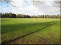
Blackweir Sports Field
Blackweir Sports Field in Bute Park, Cardiff.
Image: © Philip Halling
Taken: 17 Jan 2009
0.08 miles
8
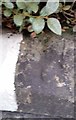
Ordnance Survey Rivet
This damaged OS rivet can be found on the wall between No132 and No134 Colum Road. It marks a point 15.237m above mean sea level.
Image: © Adrian Dust
Taken: 1 Oct 2017
0.10 miles
9
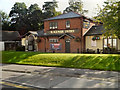
Blackweir Tavern
The Blackweir Tavern an North Road, Cardiff.
Image: © David Dixon
Taken: 29 Aug 2012
0.10 miles
10
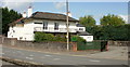
Rose Mount Funeral Home, Cardiff
30 North Road.
Image: © Jaggery
Taken: 28 Aug 2009
0.14 miles