1
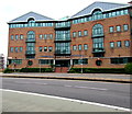
St Andrew's Lane, Cardiff
Viewed across St Andrew's Place. Out of shot ahead, the far end of St Andrew's Lane joins the A4161 Stuttgarter Strasse, named for one of Cardiff's twin cities.
Image: © Jaggery
Taken: 20 Oct 2013
0.02 miles
2
Dumfries House, Dumfries Place, Cardiff
In June 2017 Dumfries House is the office of law firm Geldards LLP.
LLP is a limited liability partnership in which a partner is not responsible
or liable for another partner's misconduct or negligence.
Image: © Jaggery
Taken: 8 Jun 2017
0.03 miles
3
Cardiff : Saint Andrew's Lane
Looking along Saint Andrew's Lane in Cardiff.
Image: © Lewis Clarke
Taken: 30 Mar 2014
0.03 miles
4
Flooding in Cardiff
After a night of heavy rain, a number of low points (usually under bridges) flooded. This is the Salisbury Road railway bridge. The water was well over a metre high under the bridge - note the roof of the vehicle in the middle of it!
Image: © Gareth James
Taken: Unknown
0.03 miles
5
Flooding in Cardiff
A view of the floods in
Image, but taken from further back, showing the extent of the water.
Image: © Gareth James
Taken: Unknown
0.04 miles
6
West side of St Andrew's Place railway bridge, Cardiff
The road passes under railway lines between Queen Street station and Cathays station.
I didn't look up as I walked under the bridge, so was surprised at the view of the other side. http://www.geograph.org.uk/photo/3712230
The answer is of course, two parallel bridges.
Image: © Jaggery
Taken: 20 Oct 2013
0.04 miles
7
St Andrew's House, Cardiff
Office building at 24 St Andrew's Crescent, viewed across St Andrew's Place.
Image: © Jaggery
Taken: 20 Oct 2013
0.04 miles
8
East side of St Andrew's Place railway bridge, Cardiff
There are two bridges here, side by side. http://www.geograph.org.uk/photo/3712223 to a view of the opposite side.
Image: © Jaggery
Taken: 20 Oct 2013
0.05 miles
9
Dumfries House and Marchmount House, Cardiff
Separately-named offices in one large building in Dumfries Place. Dumfries House is on the left.
Image: © Jaggery
Taken: 20 Oct 2013
0.06 miles
10
Class 37 near Cardiff Queen Street
Class 37 No. 37421 approaches Queen Street North Junction with a training run from Rhymney to Cardiff Canton depot.
Image: © Gareth James
Taken: 7 Jun 2019
0.06 miles


