
IMAGES TAKEN NEAR TO
St. Andrews Crescent, CARDIFF, CF10 3DB
Introduction
This page details the photographs taken nearby to St. Andrews Crescent, CF10 3DB by members of the Geograph project.
The Geograph project started in 2005 with the aim of publishing, organising and preserving representative images for every square kilometre of Great Britain, Ireland and the Isle of Man.

There are currently over 7.5m images from over14,400 individuals and you can help contribute to the project by visiting https://www.geograph.org.uk
Image Map
Images are licensed for reuse under creativecommons.org/licenses/by-sa/2.0
Notes
- Clicking on the map will re-center to the selected point.
- The higher the marker number, the further away the image location is from the centre of the postcode.
Image Listing (541 Images Found)
Images are licensed for reuse under creativecommons.org/licenses/by-sa/2.0
Image
Details
Distance
1
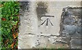
Ordnance Survey Cut Mark
This OS cut mark can be found on the west face of St David's Church. It marks a point 13.506m above mean sea level.
Image: © Adrian Dust
Taken: 1 Oct 2017
0.02 miles
2
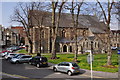
Cardiff : Eglwys Dewl Sant
A church which serves the Welsh speaking population of Cardiff; this includes those who have been born and brought up in the capital city, those who have moved here and those who - for whatever reason - wish to learn Welsh.
Image: © Lewis Clarke
Taken: 30 Mar 2014
0.04 miles
3
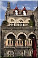
Cardiff : Park House
Park House, formerly known as McConnochie House, is a town house in Cardiff. It was built for James McConnochie, Chief Engineer to the Bute Docks, by the Gothic revivalist architect William Burges. It is a Grade I listed building. "By its powerful early French Gothic style, its steep roofs and boldly textured walls (the house) revolutionized Cardiff's domestic architecture."
Image: © Lewis Clarke
Taken: 30 Mar 2014
0.05 miles
4

Four-storey office building in Cardiff city centre
On the corner of the A4161 Stuttgarter Strasse and Park Lane.
This part of the A4161 is named after one of Cardiff's twin cities.
Stuttgart is the capital and largest city of the German state of Baden-Württemberg.
Image: © Jaggery
Taken: 8 Jun 2017
0.05 miles
5
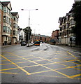
East along Stuttgarter Strasse, Cardiff
The A4161 behind the camera is named Boulevard de Nantes.
Ahead, the A4161 is named Stuttgarter Strasse.
Nantes in France and Stuttgart in Germany are two of Cardiff's twin cities.
Image: © Jaggery
Taken: 24 Aug 2017
0.05 miles
6
Cardiff : St Andrew's Street
Looking along St Andrew's Street from Park Place.
Image: © Lewis Clarke
Taken: 30 Mar 2014
0.05 miles
7
St Andrew's House, Cardiff
Office building at 24 St Andrew's Crescent, viewed across St Andrew's Place.
Image: © Jaggery
Taken: 20 Oct 2013
0.05 miles
8
Oakleigh House, Cardiff city centre
Four-storey offices on the corner of Park Place and Stuttgarter Strasse.
Image: © Jaggery
Taken: 24 Aug 2017
0.05 miles
9
Cardiff : Park Place
Park Place heading through Cardiff City Centre.
Image: © Lewis Clarke
Taken: 30 Mar 2014
0.05 miles
10
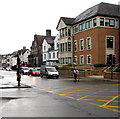
North along Park Place, Cardiff
Viewed across the A4161.
Image: © Jaggery
Taken: 24 Aug 2017
0.06 miles