1
A view south from Cardiff Queen Street railway station
The lines on the right and centre left head towards Cardiff Central station, about a kilometre away.
The line on the left, from platform 3, is used by the Cardiff Bay shuttle http://www.geograph.org.uk/photo/2991855.
Image: © Jaggery
Taken: 13 Jun 2012
0.01 miles
2
Disappearing Cardiff, Guildford Crescent
Another remnant of old Cardiff apparently scheduled for demolition.
Image: © John Lord
Taken: 5 Mar 2019
0.02 miles
3
Railway south towards Central from Queen Street, Cardiff
Looking south from Cardiff Queen Street station towards Cardiff Central station.
In late January 2014, work was in progress on the right on the construction of a new platform.
Based on passenger usage (2006-2007 figures), Cardiff Queen Street is the second busiest railway station in Wales. Cardiff Central is the busiest, Newport the third busiest.
Image: © Jaggery
Taken: 25 Jan 2014
0.02 miles
4
Thai House restaurant in Cardiff
Thai cuisine restaurant in Guildford Crescent, viewed from the edge of Churchill Way.
Image: © Jaggery
Taken: 20 Oct 2013
0.03 miles
5
Madeira Restaurante, Cardiff
Portuguese restaurant (which explains the e at the end of restaurant in its name) in Guildford Crescent. Thai House http://www.geograph.org.uk/photo/3717633 is on the right.
Image: © Jaggery
Taken: 20 Oct 2013
0.03 miles
6
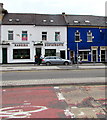
Madeira Restaurante, 2 Guildford Crescent, Cardiff
City centre Portuguese restaurant viewed across Churchill Way.
In June 2017 the national flag of Portugal is in one upstairs window.
The national flag of Wales is in another upstairs window.
Image: © Jaggery
Taken: 10 Jun 2017
0.03 miles
7
Thai House Restaurant, Guildford Crescent, Cardiff
City centre Thai restaurant viewed across Churchill Way. A University of South Wales building is on the right.
Image: © Jaggery
Taken: 10 Jun 2017
0.03 miles
8
Guildford Crescent, Cardiff
This area is likely to be redeveloped soon. What a loss to Cardiff!
Image: © Alan Hughes
Taken: 4 Jan 2019
0.03 miles
9
Disappearing Cardiff
Another remnant of old Cardiff apparently awaiting demolition. On the extreme left of the photo is part of the Masonic Temple. Will it share its neighbours' fate?
Image: © John Lord
Taken: 5 Mar 2019
0.03 miles
10
Looking south from Cardiff Queen Street Station
From the end of Platforms 1 and 2.
Image: © Richard Sutcliffe
Taken: 8 Jun 2016
0.03 miles


