
IMAGES TAKEN NEAR TO
St. Botolphs Way, HAVERHILL, CB9 9NH
Introduction
This page details the photographs taken nearby to St. Botolphs Way, CB9 9NH by members of the Geograph project.
The Geograph project started in 2005 with the aim of publishing, organising and preserving representative images for every square kilometre of Great Britain, Ireland and the Isle of Man.

There are currently over 7.5m images from over14,400 individuals and you can help contribute to the project by visiting https://www.geograph.org.uk
Image Map
Images are licensed for reuse under creativecommons.org/licenses/by-sa/2.0
Notes
- Clicking on the map will re-center to the selected point.
- The higher the marker number, the further away the image location is from the centre of the postcode.
Image Listing (28 Images Found)
Images are licensed for reuse under creativecommons.org/licenses/by-sa/2.0
Image
Details
Distance
2
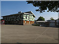
Place Farm Primary Academy
School in Haverhill.
Image: © Hugh Venables
Taken: 20 Sep 2015
0.07 miles
3
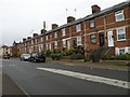
Vine Cottages
Terrace on Burton End, ca. 1900
Image: © Keith Edkins
Taken: 15 Nov 2017
0.08 miles
5

Weavers Row
Terrace of 12 houses on Burton End, which were once workplaces of silk weavers. The looms were on the first floors, which have larger windows to improve the lighting in the work areas.
Image: © Keith Edkins
Taken: 15 Nov 2017
0.10 miles
6

Clements Lane, Haverhill
A recreation ground on the right.
Image: © Robin Webster
Taken: 3 Jun 2018
0.10 miles
7

Thatched Nursery
This is Lilypads Day Nursery http://www.lilypadsnursery.co.uk/
Image: © Glyn Baker
Taken: 20 Apr 2021
0.12 miles
8
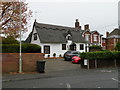
Lilypads Nursery
Timber-framed building, partly mid 17th century. Grade II listed. Now a day nursery and pre-school.
Image: © Keith Edkins
Taken: 15 Nov 2017
0.12 miles
10
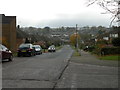
View from North Avenue
The view crosses the dense housing developments around Greenfields Way to the Industrial Estates near the southern bypass
Image: © Keith Edkins
Taken: 15 Nov 2017
0.13 miles