
IMAGES TAKEN NEAR TO
Ganwick Close, HAVERHILL, CB9 9JX
Introduction
This page details the photographs taken nearby to Ganwick Close, CB9 9JX by members of the Geograph project.
The Geograph project started in 2005 with the aim of publishing, organising and preserving representative images for every square kilometre of Great Britain, Ireland and the Isle of Man.

There are currently over 7.5m images from over14,400 individuals and you can help contribute to the project by visiting https://www.geograph.org.uk
Image Map
Images are licensed for reuse under creativecommons.org/licenses/by-sa/2.0
Notes
- Clicking on the map will re-center to the selected point.
- The higher the marker number, the further away the image location is from the centre of the postcode.
Image Listing (8 Images Found)
Images are licensed for reuse under creativecommons.org/licenses/by-sa/2.0
Image
Details
Distance
1
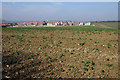
Haverhill housing estate
New housing to the north of Haverhill gobbling up the countryside.
Image: © Adrian Perkins
Taken: 4 Apr 2007
0.17 miles
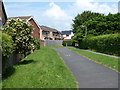
3
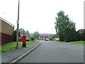
Howe Road
Looking down Howe Road at Haverhill, Suffolk.
Image: © Keith Evans
Taken: 24 May 2012
0.21 miles
4
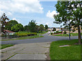
Suburban Haverhill
Looking across Chapple Drive up Trinity Link.
Image: © Robin Webster
Taken: 3 Jun 2018
0.21 miles
5
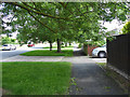
Suburban Haverhill
Looking east, Chapple Drive.
Image: © Robin Webster
Taken: 3 Jun 2018
0.22 miles
6
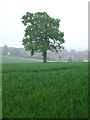
Single Tree
Single tree in farmers field near to Haverhill, Suffolk.
Image: © Keith Evans
Taken: 24 May 2012
0.23 miles
7
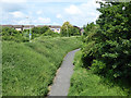
Path heading north from Withersfield Road
Formerly a public byway to Great Wratting, this southern part through housing development now seems to be reduced to a footpath. A view from the old railway bridge here, now carrying another path.
Image: © Robin Webster
Taken: 3 Jun 2018
0.23 miles
8
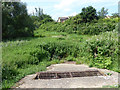
Marshy area, Haverhill
This seems to be a balancing pond, presumably to attenuate the peak run-off from the housing area to the right into the Stour Brook. The brook is off to the left on the other side of the old railway line.
Image: © Robin Webster
Taken: 3 Jun 2018
0.23 miles