IMAGES TAKEN NEAR TO
Swan Lane, HAVERHILL, CB9 9EQ
Introduction
This page details the photographs taken nearby to Swan Lane, CB9 9EQ by members of the Geograph project.
The Geograph project started in 2005 with the aim of publishing, organising and preserving representative images for every square kilometre of Great Britain, Ireland and the Isle of Man.

There are currently over 7.5m images from over14,400 individuals and you can help contribute to the project by visiting https://www.geograph.org.uk
Image Map
Images are licensed for reuse under creativecommons.org/licenses/by-sa/2.0
Notes
- Clicking on the map will re-center to the selected point.
- The higher the marker number, the further away the image location is from the centre of the postcode.
Image Listing (138 Images Found)
Images are licensed for reuse under creativecommons.org/licenses/by-sa/2.0
Image
Details
Distance
1
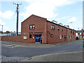
Haverhill police station
Cunningly built in the flood risk zone of the Stour Brook. I hope the dungeons are not below ground level.
Image: © Robin Webster
Taken: 3 Jun 2018
0.01 miles
2
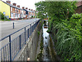
The Stour Brook, Haverhill
Looking tame here, but it has flooded the town from time to time. In the 1970s a 'washland' scheme upstream was engineered and seems to have put a stop to that. Looking downstream.
Image: © Robin Webster
Taken: 3 Jun 2018
0.01 miles
4
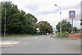
Roundabout on Lord's Croft Lane, Haverhill
Image: © David Howard
Taken: 23 Aug 2020
0.02 miles
5
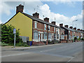
Houses on Lord's Croft Lane, Haverhill
There were built around 1900.
Image: © Robin Webster
Taken: 3 Jun 2018
0.03 miles

8

Thing-Me-Bobs, Haverhill
On Queens Street.
Image: © Hugh Venables
Taken: 20 Sep 2015
0.04 miles
9

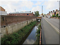
The Stour Brook, Haverhill
Looking tame here, but it has flooded the town from time to time. In the 1970s a 'washland' scheme upstream was engineered and seems to have put a stop to that. Looking downstream.
Image: © Robin Webster
Taken: 3 Jun 2018
0.05 miles