IMAGES TAKEN NEAR TO
Burton Green, HAVERHILL, CB9 7SB

Introduction

This page details the photographs taken nearby to Burton Green, CB9 7SB by members of the Geograph project.

The Geograph project started in 2005 with the aim of publishing, organising and preserving representative images for every square kilometre of Great Britain, Ireland and the Isle of Man.

There are currently over 7.5m images from over14,400 individuals and you can help contribute to the project by visiting https://www.geograph.org.uk

Image Map


Images are licensed for reuse under creativecommons.org/licenses/by-sa/2.0
Notes
  • Clicking on the map will re-center to the selected point.
  • The higher the marker number, the further away the image location is from the centre of the postcode.

Image Listing (12 Images Found)

Images are licensed for reuse under creativecommons.org/licenses/by-sa/2.0
Image
Details
Distance
1
Withersfield: Burton Green
One of two greens in Withersfield, photographed on a sunny Sunday morning in August.
Image: © John Sutton Taken: 13 Aug 2017
0.05 miles
2
Burton Green
The green at Burton Green, Suffolk.
Image: © Keith Evans Taken: 23 Jun 2011
0.05 miles
3
Looking across Burton Green, Withersfield, Suffolk
Image: © Robert Edwards Taken: 27 Apr 2006
0.11 miles
4
The Old Bakery at Withersfield, now residential
Image: © Adrian S Pye Taken: 27 Apr 2015
0.12 miles
5
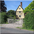
Withersfield: Guildhall
A 17th-century Grade II listed timber-framed house, restored in the twentieth century and recently repainted.
Image: © John Sutton Taken: 13 Aug 2017
0.13 miles
6
Withersfield: junction, signpost and stinkpipe
This is where the lane from Great Wratting meets the road from Withersfield to Great Thurlow (right). The rusty stinkpipe has the usual sort of decorative cast-iron base and a wire cap (like a small steam locomotive's spark arrester), to stop birds nesting I imagine.
Image: © John Sutton Taken: 17 Nov 2021
0.14 miles
7
Withersfield: a fine chimney stack on Thurlow Road
The 17th-century timber-framed house is Guildhall.
Image: © John Sutton Taken: 13 Aug 2017
0.14 miles
8
Field beans near Withersfield
Looking south-west from Highnoon Lane, with the water tower at Mill Green showing on the skyline in the centre.
Image: © John Sutton Taken: 13 Aug 2017
0.18 miles
9
Highnoon Lane
Track marked on the O.S. map as Highnoon Lane at Withersfield, Suffolk.
Image: © Keith Evans Taken: 23 Jun 2011
0.19 miles
10
Thurlow Road, Withersfield
Image: © Adrian S Pye Taken: 27 Apr 2015
0.19 miles