
IMAGES TAKEN NEAR TO
School Terrace, HAVERHILL, CB9 7RX
Introduction
This page details the photographs taken nearby to School Terrace, CB9 7RX by members of the Geograph project.
The Geograph project started in 2005 with the aim of publishing, organising and preserving representative images for every square kilometre of Great Britain, Ireland and the Isle of Man.

There are currently over 7.5m images from over14,400 individuals and you can help contribute to the project by visiting https://www.geograph.org.uk
Image Map
Images are licensed for reuse under creativecommons.org/licenses/by-sa/2.0
Notes
- Clicking on the map will re-center to the selected point.
- The higher the marker number, the further away the image location is from the centre of the postcode.
Image Listing (23 Images Found)
Images are licensed for reuse under creativecommons.org/licenses/by-sa/2.0
Image
Details
Distance
1

Entrance to Hall Farm - No through road
Image: © Adrian S Pye
Taken: 27 Apr 2015
0.04 miles
3
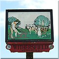
Withersfield village sign
The sign depicts the osier harvest. The strange thing is Withersfield have no history of harvesting osiers or even basket making.
https://www.geograph.org.uk/photo/4295578
Image: © Adrian S Pye
Taken: 29 Mar 2021
0.08 miles

5
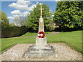
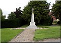
Withersfield War Memorial
There are 15 names of men lost in the Great War on Withersfield Memorial although at first glance none are apparent. Only closer inspection will reveal three facets bear five names each. with the text "Let those that come after see their names be not forgotten." A little cleaning occasionally wouldn't go amiss.
On the second plinth is a single name of a man lost in the Second World War.
Image: © Adrian S Pye
Taken: 27 Apr 2015
0.08 miles
6
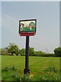
Withersfield village sign
The sign depicts the osier harvest. The strange thing is Withersfield have no history of harvesting osiers or even basket making. https://www.geograph.org.uk/photo/6790888
Image: © Adrian S Pye
Taken: 30 Apr 2007
0.09 miles
7
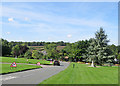
Withersfield: roadworks
Temporary traffic lights at the road junction next to the war memorial on Town Green. The centre of the village is in the valley of Stour Brook, a tributary of the River Stour.
Image: © John Sutton
Taken: 13 Aug 2017
0.10 miles
8
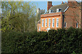
Withersfield
Georgian house in Withersfield.
Image: © Adrian Perkins
Taken: 4 Apr 2007
0.12 miles
9
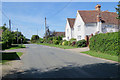
Withersfield: on Turnpike Hill
The 17th/18th-century timber-framed house on the right is Grade II listed.
Image: © John Sutton
Taken: 13 Aug 2017
0.12 miles
10

Village Road
Village road at Withersfield, Suffolk.
Image: © Keith Evans
Taken: 15 Sep 2011
0.14 miles