
IMAGES TAKEN NEAR TO
Westward Deals, HAVERHILL, CB9 7PL
Introduction
This page details the photographs taken nearby to Westward Deals, CB9 7PL by members of the Geograph project.
The Geograph project started in 2005 with the aim of publishing, organising and preserving representative images for every square kilometre of Great Britain, Ireland and the Isle of Man.

There are currently over 7.5m images from over14,400 individuals and you can help contribute to the project by visiting https://www.geograph.org.uk
Image Map
Images are licensed for reuse under creativecommons.org/licenses/by-sa/2.0
Notes
- Clicking on the map will re-center to the selected point.
- The higher the marker number, the further away the image location is from the centre of the postcode.
Image Listing (87 Images Found)
Images are licensed for reuse under creativecommons.org/licenses/by-sa/2.0
Image
Details
Distance
1
![Path leaves the road [3]](https://s0.geograph.org.uk/geophotos/06/17/99/6179960_63b744c1_120x120.jpg)
Path leaves the road [3]
The footpath, Church Walk, runs from Westend Lane to Mill Road.
Image: © Michael Dibb
Taken: 15 May 2019
0.08 miles
2
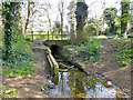
Bridge on Church Walk, Kedington
The brook joins the Stour not far away. Looking upstream.
Image: © Robin Webster
Taken: 8 Apr 2017
0.08 miles
3
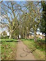
Footpath to school and church, Kedington
This path links the village centre with its school and church.
Image: © Bob Jones
Taken: 8 Feb 2011
0.09 miles
4
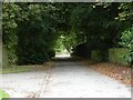
Part of the Stour Valley Path
This section of the path is opposite Keddington parish church.
Image: © Robert Edwards
Taken: 31 Jul 2009
0.09 miles
5
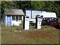
What price a gallon?
Old petrol pumps at a car repair business in Westend Lane.
Image: © Michael Dibb
Taken: 15 May 2019
0.10 miles
6
![Kedington buildings [6]](https://s1.geograph.org.uk/geophotos/06/17/99/6179965_61981ed9_120x120.jpg)
Kedington buildings [6]
The fairly recent buildings of Kedington Primary Academy, seen from Church Walk.
Image: © Michael Dibb
Taken: 15 May 2019
0.11 miles
7
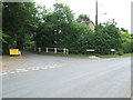
Dash End Lane
The start of Dash End lane at Kedington, Suffolk.
Image: © Keith Evans
Taken: 9 Jun 2011
0.12 miles
8

Church Walk
Seen here from near Mill Road, the delightful path runs to Westend Lane.
Image: © Michael Dibb
Taken: 15 May 2019
0.12 miles
9
![Kedington houses [13]](https://s3.geograph.org.uk/geophotos/06/17/97/6179775_5052f757_120x120.jpg)
Kedington houses [13]
Suffolk House is early 19th century brick built. The fine, tall brick and knapped flint wall attached runs for almost 30 yards. Listed, grade II, with details at: https://historicengland.org.uk/listing/the-list/list-entry/1031632
Image: © Michael Dibb
Taken: 15 May 2019
0.12 miles
10
![Kedington houses [14]](https://s0.geograph.org.uk/geophotos/06/17/97/6179780_8da037e8_120x120.jpg)
Kedington houses [14]
The Old Stores in Silver Street was formerly the village stores. It is 17th century timber framed and plastered and was much altered in the 18th century. The Old Stores and the adjoining Kimcot and The Cottage are listed, grade II, with details at: https://historicengland.org.uk/listing/the-list/list-entry/1031636
Image: © Michael Dibb
Taken: 15 May 2019
0.12 miles