
IMAGES TAKEN NEAR TO
Dane Common, HAVERHILL, CB9 7NU
Introduction
This page details the photographs taken nearby to Dane Common, CB9 7NU by members of the Geograph project.
The Geograph project started in 2005 with the aim of publishing, organising and preserving representative images for every square kilometre of Great Britain, Ireland and the Isle of Man.

There are currently over 7.5m images from over14,400 individuals and you can help contribute to the project by visiting https://www.geograph.org.uk
Image Map
Images are licensed for reuse under creativecommons.org/licenses/by-sa/2.0
Notes
- Clicking on the map will re-center to the selected point.
- The higher the marker number, the further away the image location is from the centre of the postcode.
Image Listing (43 Images Found)
Images are licensed for reuse under creativecommons.org/licenses/by-sa/2.0
Image
Details
Distance
1
![Kedington buildings [3]](https://s0.geograph.org.uk/geophotos/06/17/96/6179676_5c674b23_120x120.jpg)
Kedington buildings [3]
The former White Horse Inn is early 19th century timber framed and plastered. Now a private residence, the inn closed in 2011. Listed, grade II, with details at: https://historicengland.org.uk/listing/the-list/list-entry/1031606
Image: © Michael Dibb
Taken: 15 May 2019
0.04 miles
2
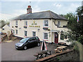
The White Horse Kedington
At the junction of White Horse road and the B1061
Image: © John Firth
Taken: 16 Sep 2010
0.04 miles
3
![Kedington houses [5]](https://s3.geograph.org.uk/geophotos/06/17/96/6179675_2a66b771_120x120.jpg)
Kedington houses [5]
Daneleigh Cottages are a pair of 18th or early 19th century cottages, timber framed, plastered and thatched. Listed, grade II, with details at: https://historicengland.org.uk/listing/the-list/list-entry/1182593
Image: © Michael Dibb
Taken: 15 May 2019
0.06 miles
4
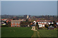
Kedington, Suffolk
Kedington seen from the west.
Image: © Adrian Perkins
Taken: 2 Apr 2007
0.07 miles
5
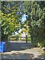
Fine gates
The entrance driveway to Kedington House with a pair of finr gates.
Image: © Michael Dibb
Taken: 15 May 2019
0.09 miles
6
![Path leaves the road [2]](https://s1.geograph.org.uk/geophotos/06/17/96/6179673_c6baa76f_120x120.jpg)
Path leaves the road [2]
The path, White Horse Lane, leaves School Road and runs to White Horse Road.
Image: © Michael Dibb
Taken: 15 May 2019
0.10 miles
7
![Kedington houses [4]](https://s0.geograph.org.uk/geophotos/06/17/96/6179672_98d4a4a5_120x120.jpg)
Kedington houses [4]
Numbers 26 and 28 School Road is 17th or 18th century timber framed, plastered and, until recently, thatched. Listed, grade II, with details at: https://historicengland.org.uk/listing/the-list/list-entry/1031635
Image: © Michael Dibb
Taken: 15 May 2019
0.11 miles
8
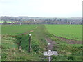
To Kedington
Footpath leading to Kedington, Suffolk.
Image: © Keith Evans
Taken: 21 Nov 2013
0.12 miles
9
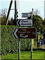
Roadsigns on Mill Road
At the junction with the B1061 Haverhill Road
(Close up)
Image: © Geographer
Taken: 3 Oct 2014
0.12 miles
10
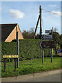
Roadsigns on Mill Road
At the junction with the B1061 Haverhill Road
Image: © Geographer
Taken: 3 Oct 2014
0.12 miles