
IMAGES TAKEN NEAR TO
Water Lane, HAVERHILL, CB9 7DS
Introduction
This page details the photographs taken nearby to Water Lane, CB9 7DS by members of the Geograph project.
The Geograph project started in 2005 with the aim of publishing, organising and preserving representative images for every square kilometre of Great Britain, Ireland and the Isle of Man.

There are currently over 7.5m images from over14,400 individuals and you can help contribute to the project by visiting https://www.geograph.org.uk
Image Map
Images are licensed for reuse under creativecommons.org/licenses/by-sa/2.0
Notes
- Clicking on the map will re-center to the selected point.
- The higher the marker number, the further away the image location is from the centre of the postcode.
Image Listing (44 Images Found)
Images are licensed for reuse under creativecommons.org/licenses/by-sa/2.0
Image
Details
Distance
1
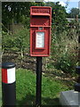
Elizabeth II postbox on Queen Edith Drive, Steeple Bumpstead
Postbox No. CB9 32.
See Image] for context.
Image: © JThomas
Taken: 2 Sep 2017
0.02 miles
2
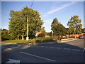
Water Lane at the junction of Queen Edith Drive
Image: © David Howard
Taken: 27 Aug 2017
0.02 miles
3
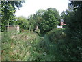
Dry stream, Steeple Bumpstead
Widened after flooding in 2007 - Image]
Image: © JThomas
Taken: 2 Sep 2017
0.03 miles
4
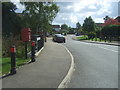
Queen Edith Drive, Steeple Bumpstead
Showing position of Postbox No. CB9 32.
See Image] for postbox.
Image: © JThomas
Taken: 2 Sep 2017
0.03 miles
5
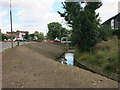
Stream widening, Steeple Bumpstead
Part of the £4 million Steeple Bumpstead Flood Alleviation Scheme. There are several new bridges required to remove restrictions on Helions Brook and Bumpstead Brook, hence the high cost. See Image for the reason why it is needed, the area also flooded in 2009.
Image: © Hugh Venables
Taken: 7 Jul 2014
0.05 miles
7
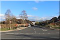
Queen Edith Drive, Steeple Bumpstead
Queen Edith was Queen Consort of Wessex, the wife of Edward the Confessor. I don't think Wessex reached this far east.
Image: © David Howard
Taken: 14 Mar 2019
0.06 miles
8
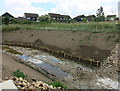
Newly engineered channel, Steeple Bumpstead
Part of the £4 million Steeple Bumpstead Flood Alleviation Scheme. There are several new bridges required to remove restrictions on Helions Brook and Bumpstead Brook, hence the high cost. See Image for the reason why it is needed, the area also flooded in 2009.
Image: © Hugh Venables
Taken: 7 Jul 2014
0.07 miles
9
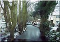
Bumpstead Brook
This was the view of the brook to the West from the village Ford in December 2005.
Image: © Linda
Taken: 1 Dec 2005
0.10 miles
10

Ordnance Survey Flush Bracket 1343
This can be found on the wall of a private dwelling in Water lane, Steeple Bumpstead.
For more detail see : http://www.bench-marks.org.uk/bm1371
Image: © Peter Wood
Taken: 25 Feb 2015
0.11 miles