IMAGES TAKEN NEAR TO
Lark Hill, NEWMARKET, CB8 8RT
Introduction
This page details the photographs taken nearby to Lark Hill, CB8 8RT by members of the Geograph project.
The Geograph project started in 2005 with the aim of publishing, organising and preserving representative images for every square kilometre of Great Britain, Ireland and the Isle of Man.

There are currently over 7.5m images from over14,400 individuals and you can help contribute to the project by visiting https://www.geograph.org.uk
Image Map
Images are licensed for reuse under creativecommons.org/licenses/by-sa/2.0
Notes
- Clicking on the map will re-center to the selected point.
- The higher the marker number, the further away the image location is from the centre of the postcode.
Image Listing (6 Images Found)
Images are licensed for reuse under creativecommons.org/licenses/by-sa/2.0
Image
Details
Distance
1
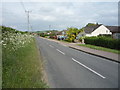
Newmarket Road, Moulton
Looking north east on National Cycle Route 51.
Image: © JThomas
Taken: 21 May 2016
0.13 miles
3
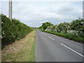
National Cycle Route 51
Heading north east towards Moulton.
Image: © JThomas
Taken: 21 May 2016
0.19 miles
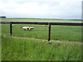
5
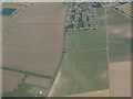
Patterned ground on field W of Moulton, Suffolk: aerial 2022
Image: © Simon Tomson
Taken: 19 Jul 2022
0.23 miles
6
![Moulton houses [8]](https://s2.geograph.org.uk/geophotos/06/72/14/6721470_17acce0f_120x120.jpg)
Moulton houses [8]
Cherry Street Cottage, number 8 The Street is an attractive, thatched property.
Moulton is a small village some 3 miles east of Newmarket and was settled in Saxon times. The River Kennett flows through the village and a 15th-century packhorse bridge spans the river.
Image: © Michael Dibb
Taken: 9 Sep 2020
0.24 miles