IMAGES TAKEN NEAR TO
Gazeley Road, NEWMARKET, CB8 8QZ
Introduction
This page details the photographs taken nearby to Gazeley Road, CB8 8QZ by members of the Geograph project.
The Geograph project started in 2005 with the aim of publishing, organising and preserving representative images for every square kilometre of Great Britain, Ireland and the Isle of Man.

There are currently over 7.5m images from over14,400 individuals and you can help contribute to the project by visiting https://www.geograph.org.uk
Image Map
Images are licensed for reuse under creativecommons.org/licenses/by-sa/2.0
Notes
- Clicking on the map will re-center to the selected point.
- The higher the marker number, the further away the image location is from the centre of the postcode.
Image Listing (11 Images Found)
Images are licensed for reuse under creativecommons.org/licenses/by-sa/2.0
Image
Details
Distance
1
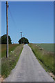
Track to Primrose Hill Farm
This metalled track leads north-eastwards from the minor road between Moulton and Gazeley, towards a farm which is situated out of sight over the top of the hill.
Image: © Bob Jones
Taken: 12 Jun 2009
0.10 miles
3
Primrose Hill View
Looking W towards Moulton from the entrance to Primrose Hill Farm from the road out of Moulton
Image: © mike
Taken: 1 Nov 2005
0.13 miles
4
Road to Primrose Hill Farm
Off Gazeley Road.
Image: © JThomas
Taken: 21 May 2016
0.14 miles
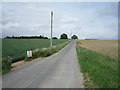
6
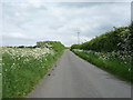
Gazeley Road
National Cycle Route 51 - looking south east.
Image: © JThomas
Taken: 21 May 2016
0.17 miles
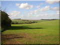
7
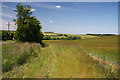
View towards Moulton
This view from near the junction of the track to Primrose Hill Farm and the minor road between Moulton and Gazeley looks across open farmland towards the northern end of the village of Moulton. The road can be seen to the left of the photo.
Image: © Bob Jones
Taken: 12 Jun 2009
0.19 miles
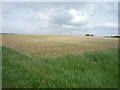
8
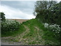
Farm track (footpath) off Gazeley Road
Looking south from National Cycle Route 51.
Image: © JThomas
Taken: 21 May 2016
0.20 miles
9
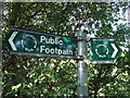
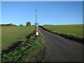
Footpath sign
Footpath sign near to Moulton Suffolk.
Image: © Keith Evans
Taken: 12 Oct 2008
0.21 miles
10
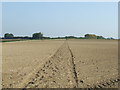
Reinstated footpath
Reinstated footpath near to Moulton Suffolk.
Image: © Keith Evans
Taken: 12 Oct 2008
0.24 miles