1
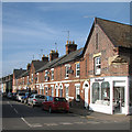
All Saints Road, Newmarket
Image: © Hugh Venables
Taken: 22 Dec 2016
0.03 miles
2
Cottages, All Saints Road
Hard to judge the age of flint buildings, I think these are probably Victorian but much modified. Note the ornate ground-floor window in the farthest one. They used to have hexagonal roofing tiles (Google StreetView 2010) but those have now gone.
Image: © Keith Edkins
Taken: 12 Jun 2018
0.04 miles
3
Newmarket: Victoria Terrace, All Saints Road
The corner of All Saints Road and Vicarage Road early on a bright October afternoon.
Image: © John Sutton
Taken: 31 Oct 2015
0.06 miles
4
Malt Close
Image: © N Chadwick
Taken: 10 Feb 2018
0.07 miles
5
Newmarket 1st railway station (site), Suffolk
Opened in 1848 by the Newmarket and Chesterford Railway, later part of the Great Eastern Railway, this terminus station closed in 1902 to passengers, and completely in 1967. It was replaced by the current Newmarket station on the through-line from Cambridge to Bury St Edmunds, which is behind the house to the right.
View north towards the buffers. The site has been completely redeveloped with the cul-de-sac occupying the former forecourt, and the houses are built on the site of the station building.
Image: © Nigel Thompson
Taken: 5 Feb 2016
0.12 miles
6
All Saints Road, Newmarket
Image: © Andrew Hill
Taken: 10 Oct 2007
0.13 miles
7
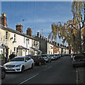
Newmarket: All Saints Road
Sunshine and shadows early on an autumn afternoon.
Image: © John Sutton
Taken: 31 Oct 2015
0.14 miles
8
Newmarket-Bury St Edmunds railway line
Image: © Nigel Thompson
Taken: 5 Feb 2016
0.14 miles
9
1848 Railway Station
Newmarket’s first station was the terminus of the Newmarket & Chesterford Railway. It was built on this site in 1848, and consisted of a single platform to the west of the current line. This continued in use when the Warren Hill tunnel was built, and the line to Bury St Edmunds was opened in 1854. When the Ely line was opened in 1879 a new through platform was opened, joined by a footbridge.
A new station was built approximately half a mile south in 1902, and the original one was used for goods traffic, it closed in 1967, and was demolished c.1985, the site was used for housing.
The photo was taken from above the tunnel entrance, looking south towards the current station. The terminus stood to the right, now submerged in houses.
Image: © Tony Lewis
Taken: 19 Jan 2009
0.14 miles
10
Disused Victorian postbox
The door has been removed and the box is now a repository for old fish and chip wrappers. The wall in which the postbox is set marks the start of the railway tunnel under Warren Hill.
Image: © Bob Jones
Taken: 30 Jun 2008
0.17 miles


