IMAGES TAKEN NEAR TO
George Gibson Close, NEWMARKET, CB8 7LE

Introduction

This page details the photographs taken nearby to George Gibson Close, CB8 7LE by members of the Geograph project.

The Geograph project started in 2005 with the aim of publishing, organising and preserving representative images for every square kilometre of Great Britain, Ireland and the Isle of Man.

There are currently over 7.5m images from over14,400 individuals and you can help contribute to the project by visiting https://www.geograph.org.uk

Image Map


Images are licensed for reuse under creativecommons.org/licenses/by-sa/2.0
Notes
  • Clicking on the map will re-center to the selected point.
  • The higher the marker number, the further away the image location is from the centre of the postcode.

Image Listing (20 Images Found)

Images are licensed for reuse under creativecommons.org/licenses/by-sa/2.0
Image
Details
Distance
1
Glanely Gardens, Exning
Image: © Alex McGregor Taken: 1 Mar 2011
0.14 miles
2
Highfield Lodge, Windmill Hill, New House
Image: © Alex McGregor Taken: 23 Jan 2012
0.15 miles
3
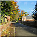
Exning: red brick and autumn leaves
Cotton End Road on the bright morning of Remembrance Sunday.
Image: © John Sutton Taken: 12 Nov 2017
0.16 miles
4
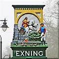
Exning village sign
Image: © Adrian S Pye Taken: 17 Aug 2007
0.18 miles
5
Exning War Memorial in Cotton End Road
There are 80 WW1 names on the memorial. For some reason another 27 were omitted at the time. In addition there are 22 names for WW2 plus 2 civilians also killed by bombing.
Image: © Adrian S Pye Taken: 18 Mar 2015
0.20 miles
6
War memorial in Exning
Situated so it is visible on a busy road junction. There are a lot of names on it for a village.
Image: © Bill Boaden Taken: 20 Apr 2015
0.20 miles
7
War Memorial, Exning
Image: © JThomas Taken: 5 Mar 2016
0.20 miles
8
Exning: on Cotton End Road in autumn
Exning Estate Office is on the left, the cricket ground beyond the trees to the right.
Image: © John Sutton Taken: 12 Nov 2017
0.20 miles
9
The new Exning village sign
The new sign which replaced the earlier one https://www.geograph.org.uk/photo/4291924 has more detail. Beneath the archway is Queen Boudicca because Exning was believed to have been the capital of the Iceni. The church of St Martin is depicted on the left, and on the right is a jockey representing the stables and the close association with adjoining Newmarket and horse racing. The two children are representing the annual duck race which takes place in June.
Image: © Adrian S Pye Taken: 18 Mar 2015
0.20 miles
10
Exning village sign
The new sign which replaced to earlier one https://www.geograph.org.uk/photo/4291924 has more detail, Beneath the archway is Queen Boadicca because Exning was believed to have been the capital of the Iceni. The church of St Martin is depicted on the left, and on the right is a jockey representing the stables and the close association with adjoining Newmarket and horse racing. The two children are representing the annual duck race which takes place in June.
Image: © Adrian S Pye Taken: 18 Mar 2015
0.20 miles