
IMAGES TAKEN NEAR TO
Isleham Marina, Fen Bank, ELY, CB7 5ZD
Introduction
This page details the photographs taken nearby to Isleham Marina, Fen Bank, CB7 5ZD by members of the Geograph project.
The Geograph project started in 2005 with the aim of publishing, organising and preserving representative images for every square kilometre of Great Britain, Ireland and the Isle of Man.

There are currently over 7.5m images from over14,400 individuals and you can help contribute to the project by visiting https://www.geograph.org.uk
Image Map
Images are licensed for reuse under creativecommons.org/licenses/by-sa/2.0
Notes
- Clicking on the map will re-center to the selected point.
- The higher the marker number, the further away the image location is from the centre of the postcode.
Image Listing (28 Images Found)
Images are licensed for reuse under creativecommons.org/licenses/by-sa/2.0
Image
Details
Distance
1
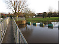
Isleham Sluice Weir
That's what it says on the sign - the Environment Agency seem to be hedging their bets as to whether this is a weir or a sluice so I will as well. Boats can avoid it by using the bypass cut the other side of the marina.
Image: © Hugh Venables
Taken: 17 Jan 2010
0.11 miles
2
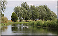
Old course of the River Lark at Isleham
This peaceful section of the River Lark at Isleham has been 'by-passed' by a straight cut between Isleham Lock and Chairlen Drove.
Image: © Bob Jones
Taken: 31 Jul 2009
0.11 miles
3
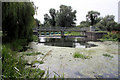
Weir on River Lark at Isleham
The old course of the River Lark has been 'by-passed' at Isleham, enabling leisure craft to avoid this weir at Riverside Island Marina.
Image: © Bob Jones
Taken: 31 Jul 2009
0.12 miles
4
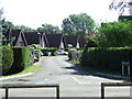
Isleham Marina
Housing at Isleham Marina, Suffolk. These houses allow you to park your car at the front and moor your boat at the back; all backing onto a water front.
Image: © Keith Evans
Taken: 13 Sep 2012
0.12 miles
5
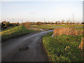
Road to Isleham Marina
Going over the flood bank, the marina development is inside the flood bank, so is designed to flood.
Image: © Hugh Venables
Taken: 17 Jan 2010
0.14 miles
6
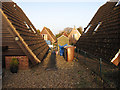
Isleham Marina
Some of the 112 Swedish style lodges on the site, which is within the raised banks of the River Lark, so each house is raised to protect against flooding. The lodges behind are the other side of a water inlet, giving each lodge a mooring. See http://www.riversideislandmarina.com/index.html
Image: © Hugh Venables
Taken: 17 Jan 2010
0.14 miles
7
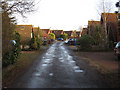
Road in Isleham Marina
The lodges have a road one side and mooring the other. http://www.riversideislandmarina.com/index.html
Image: © Hugh Venables
Taken: 17 Jan 2010
0.14 miles
8
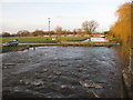
Bridge 'over' the Lark
Low bridge into Isleham Marina. From the footway over the sluice.
Image: © Hugh Venables
Taken: 17 Jan 2010
0.14 miles
9
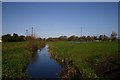
Drainage ditch near Isleham
Viewed from the road that leads to Riverside Island Marina, north of Isleham.
Image: © Bob Jones
Taken: 1 Nov 2006
0.15 miles
10
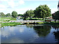
View From The Weir
View looking north from the weir at Isleham Marina, Suffolk.
Image: © Keith Evans
Taken: 13 Sep 2012
0.16 miles