IMAGES TAKEN NEAR TO
Pymoor Common, ELY, CB6 2WA
Introduction
This page details the photographs taken nearby to Pymoor Common, CB6 2WA by members of the Geograph project.
The Geograph project started in 2005 with the aim of publishing, organising and preserving representative images for every square kilometre of Great Britain, Ireland and the Isle of Man.

There are currently over 7.5m images from over14,400 individuals and you can help contribute to the project by visiting https://www.geograph.org.uk
Image Map
Images are licensed for reuse under creativecommons.org/licenses/by-sa/2.0
Notes
- Clicking on the map will re-center to the selected point.
- The higher the marker number, the further away the image location is from the centre of the postcode.
Image Listing (7 Images Found)
Images are licensed for reuse under creativecommons.org/licenses/by-sa/2.0
Image
Details
Distance
1
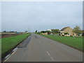
National Cycle Route 11
Heading north west on Westmoor Common near Willow Farm.
Image: © JThomas
Taken: 23 Oct 2015
0.03 miles
2

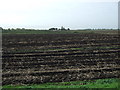
Willow Farm
From the footpath across Westmoor Common.
Image: © Hugh Venables
Taken: 11 Jan 2009
0.06 miles
4
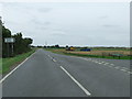
Road Junction
Road junction to Oxlode near to Pymoor, Cambridgeshire.
Image: © Keith Evans
Taken: 26 Jul 2009
0.19 miles
5
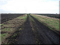
Footpath across Westmoor Common
Not so much a common as arable fields, typical of the Fens.
Image: © Hugh Venables
Taken: 11 Jan 2009
0.19 miles
6
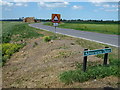
At the start of Adventurers' Drove looking along Westmoor Common
Adventurers were the equivalent of modern-day venture capitalists. They invested money in the pioneering drainage systems of the then waterlogged fens and received a percentage of the newly drained land as payment, see http://en.wikipedia.org/wiki/The_Fens#Draining_the_Fens
Image: © Richard Humphrey
Taken: 19 Jul 2013
0.20 miles