IMAGES TAKEN NEAR TO
Garden Close, ELY, CB6 2RF

Introduction

This page details the photographs taken nearby to Garden Close, CB6 2RF by members of the Geograph project.

The Geograph project started in 2005 with the aim of publishing, organising and preserving representative images for every square kilometre of Great Britain, Ireland and the Isle of Man.

There are currently over 7.5m images from over14,400 individuals and you can help contribute to the project by visiting https://www.geograph.org.uk

Image Map


Images are licensed for reuse under creativecommons.org/licenses/by-sa/2.0
Notes
  • Clicking on the map will re-center to the selected point.
  • The higher the marker number, the further away the image location is from the centre of the postcode.

Image Listing (80 Images Found)

Images are licensed for reuse under creativecommons.org/licenses/by-sa/2.0
  • ...
Image
Details
Distance
1
Sutton: down Oates' Lane
A cul-de-sac on the southern slope of the ridge on which the village stands.
Image: © John Sutton Taken: 19 Aug 2023
0.13 miles
2
looking E from Sutton tower
Image: © mym Taken: 17 Apr 2005
0.14 miles
3
Sutton church
Image: © mym Taken: 5 Mar 2004
0.14 miles
4
Sutton and flooded Ouse Washes: aerial 2019
See also Image
Image: © Chris Taken: 19 Oct 2019
0.14 miles
5
Sutton: aerial 2019
See also Image
Image: © Chris Taken: 19 Oct 2019
0.14 miles
6
Sutton: the view from the church door
Caption to follow.
Image: © John Sutton Taken: 19 Aug 2023
0.15 miles
7
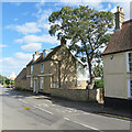
Sutton-in-the-Isle: houses on the junction of High Street and Station Road
Image: © Chris Taken: 3 Aug 2015
0.15 miles
8
Sutton: light and shade on an August afternoon
Image: © John Sutton Taken: 19 Aug 2023
0.15 miles
9
The Gables
A single house, mid C18. Grade II listed.
Image: © Keith Edkins Taken: 10 Jul 2018
0.16 miles
10
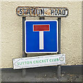
Sutton: Station Road signs
The station, on the Ely to St Ives line, lost its passenger service in 1931, though excursions continued to call until 1958.
Image: © John Sutton Taken: 19 Aug 2023
0.16 miles
  • ...