IMAGES TAKEN NEAR TO
First Westmoor Drove, ELY, CB6 1RW
Introduction
This page details the photographs taken nearby to First Westmoor Drove, CB6 1RW by members of the Geograph project.
The Geograph project started in 2005 with the aim of publishing, organising and preserving representative images for every square kilometre of Great Britain, Ireland and the Isle of Man.

There are currently over 7.5m images from over14,400 individuals and you can help contribute to the project by visiting https://www.geograph.org.uk
Image Map
Images are licensed for reuse under creativecommons.org/licenses/by-sa/2.0
Notes
- Clicking on the map will re-center to the selected point.
- The higher the marker number, the further away the image location is from the centre of the postcode.
Image Listing (5 Images Found)
Images are licensed for reuse under creativecommons.org/licenses/by-sa/2.0
Image
Details
Distance
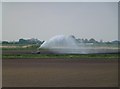
3
Irrigation near Old Pools Drove, Littleport
Image: © Richard Humphrey
Taken: 23 Apr 2014
0.18 miles
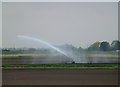
4
Irrigation rig near Old Pools Drove, Littleport
Image: © Richard Humphrey
Taken: 23 Apr 2014
0.18 miles
5
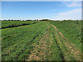
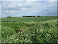
Westmoor Drove
Byway to Old Farm past a sugar beet field.
Image: © Hugh Venables
Taken: 18 Aug 2012
0.21 miles