
IMAGES TAKEN NEAR TO
Long Reach Road, CAMBRIDGE, CB4 1UJ
Introduction
This page details the photographs taken nearby to Long Reach Road, CB4 1UJ by members of the Geograph project.
The Geograph project started in 2005 with the aim of publishing, organising and preserving representative images for every square kilometre of Great Britain, Ireland and the Isle of Man.

There are currently over 7.5m images from over14,400 individuals and you can help contribute to the project by visiting https://www.geograph.org.uk
Image Map
Images are licensed for reuse under creativecommons.org/licenses/by-sa/2.0
Notes
- Clicking on the map will re-center to the selected point.
- The higher the marker number, the further away the image location is from the centre of the postcode.
Image Listing (438 Images Found)
Images are licensed for reuse under creativecommons.org/licenses/by-sa/2.0
Image
Details
Distance
1
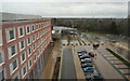
View from the fifth floor
On a wet and dismal day the view from our room on the fifth floor of the Novotel is not as inspring as it might be.
Image: © Malcolm Neal
Taken: 22 Feb 2024
0.02 miles
2
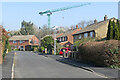
Chesterton: Long Reach Road and a crane
A council-built estate in one of the northern suburbs of Cambridge. The crane is on the construction site opposite Cambridge North railway station.
Image: © John Sutton
Taken: 23 Mar 2022
0.03 miles
3
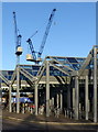
Cambridge North Station
The extensive cycle shed, with cranes rising above.
Image: © Alan Murray-Rust
Taken: 23 Dec 2019
0.04 miles
4
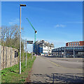
Building work at Cambridge North
Work continues (but not on a Sunday morning) on the development opposite the railway station, whose cycle sheds are on the right. I took a comparable picture, Image], in January 2022. It has a link to earlier views of the project.
Image: © John Sutton
Taken: 3 Apr 2022
0.04 miles
5
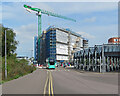
Building continues at Cambridge North
The block is to be known as One Cambridge Square - the square outside Cambridge North railway station, whose cycle sheds are on the right. This area was until some years ago covered by sidings used by the railway's permanent way and engineering departments. The road the bus is taking follows the course of the St Ives branch line, closed many years ago and now the Cambridgeshire Guided Busway.
Earlier pictures of this project:
Image]
Image]
Image]
Image]
Image]
Image: © John Sutton
Taken: 13 Sep 2022
0.04 miles
6
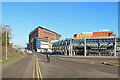
Progress at Cambridge North
Cladding has been applied to the block being built on the western side of Cambridge Square, outside the railway station. The cycle sheds are on the right of the picture.
Image] shows the state of the work in June 2022 and has a link to earlier pictures.
Image: © John Sutton
Taken: 30 Jan 2023
0.04 miles
7
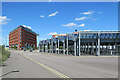
Nearing Cambridge North
The new block on the left is on Cambridge Square, opposite the station, and the station's large cycle shed is on the right. Image] was taken in January 2022, at an early stage of the Cambridge Square development.
Image: © John Sutton
Taken: 21 Aug 2023
0.04 miles
8
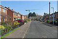
Chesterton: Bourne Road
A council-built estate in one of the northern suburbs of Cambridge. The crane is on the construction site opposite Cambridge North railway station.
Image: © John Sutton
Taken: 23 Mar 2022
0.04 miles
9
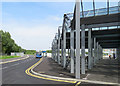
Cambridge North: bus and bicycles
The new station, served by guided buses and city services and with good provision for cyclists, including this large bike shed, opened in May 2017.
(Grid references are of necessity approximate as mapping has not kept pace with construction.)
Image: © John Sutton
Taken: 18 Jul 2017
0.04 miles
10
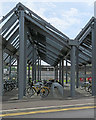
Bike sheds at Cambridge North
The new station, served by guided buses and city services and with good provision for cyclists, opened in May 2017. The platforms and one of the station signs show in the centre, beyond the cycles.
Image: © John Sutton
Taken: 18 Jul 2017
0.04 miles