
IMAGES TAKEN NEAR TO
Green End Road, CAMBRIDGE, CB4 1RY
Introduction
This page details the photographs taken nearby to Green End Road, CB4 1RY by members of the Geograph project.
The Geograph project started in 2005 with the aim of publishing, organising and preserving representative images for every square kilometre of Great Britain, Ireland and the Isle of Man.

There are currently over 7.5m images from over14,400 individuals and you can help contribute to the project by visiting https://www.geograph.org.uk
Image Map
Images are licensed for reuse under creativecommons.org/licenses/by-sa/2.0
Notes
- Clicking on the map will re-center to the selected point.
- The higher the marker number, the further away the image location is from the centre of the postcode.
Image Listing (135 Images Found)
Images are licensed for reuse under creativecommons.org/licenses/by-sa/2.0
Image
Details
Distance
3
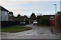
Cambridge Coral Tech
On Green End Road.
Image: © Hugh Venables
Taken: 2 Jun 2015
0.03 miles
5
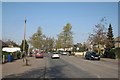
Green End Road: hints of green
On the second of the first two springlike days of 2013.
Image: © John Sutton
Taken: 5 Mar 2013
0.05 miles
8
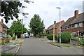
On Mortlock Avenue
Council-built houses in the north-eastern suburbs of Cambridge, off Green End Road. The abbreviated sewer vent pipe on the right also appears in Image
Image: © John Sutton
Taken: 15 Jul 2020
0.07 miles
9
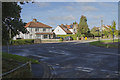
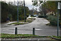
Green End Road
Looking from Nuffield Road to the junction with Green End Road. It shows some very pleasant houses and one has a few solar panels fitted.
Image: © Malcolm Neal
Taken: 8 Oct 2017
0.07 miles
10
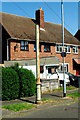
Stinkpipe 39 in Mortlock Avenue
Like the Image in the same quarter of Cambridge's north-eastern suburbs, this stench pole has been sadly truncated, losing its top stage and corona finial.
For a wider view see John Sutton's Image
Stinkpipes and Sewers of Cambridge https://www.google.com/maps/d/viewer?mid=1tGa-vqWr8XI064h9UKIdCi-HU70&ll=52.184568312439175%2C0.1690385147040141&z=12
Another pole in the parallel Maitland Avenue, listed as SP65 on the 2013 map, has disappeared without trace.
Image: © Tiger
Taken: 23 Apr 2020
0.07 miles