IMAGES TAKEN NEAR TO
Harvest Road, CAMBRIDGE, CB2 9PH
Introduction
This page details the photographs taken nearby to Harvest Road, CB2 9PH by members of the Geograph project.
The Geograph project started in 2005 with the aim of publishing, organising and preserving representative images for every square kilometre of Great Britain, Ireland and the Isle of Man.

There are currently over 7.5m images from over14,400 individuals and you can help contribute to the project by visiting https://www.geograph.org.uk
Image Map
Images are licensed for reuse under creativecommons.org/licenses/by-sa/2.0
Notes
- Clicking on the map will re-center to the selected point.
- The higher the marker number, the further away the image location is from the centre of the postcode.
Image Listing (218 Images Found)
Images are licensed for reuse under creativecommons.org/licenses/by-sa/2.0
Image
Details
Distance
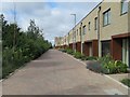
4
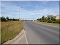
Addenbrookes Road, Trumpington, Cambridge
Image: © Geographer
Taken: 22 Jul 2019
0.04 miles
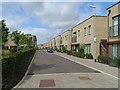
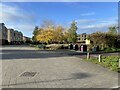
5
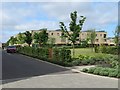
St Michael Street
The tree line protects the residents in these new builds from the busy traffic on the Addenbrooke's access road.
Image: © Fernweh
Taken: 7 Aug 2016
0.04 miles
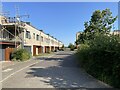
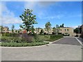
7
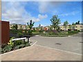
View across Viridis Park
The houses are along Vicarage Way.
Image: © Mr Ignavy
Taken: 19 Nov 2023
0.05 miles
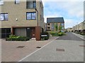
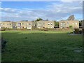
10
St Michael Street
A pleasant park area for the young families.
Image: © Fernweh
Taken: 7 Aug 2016
0.05 miles