IMAGES TAKEN NEAR TO
Paget Road, CAMBRIDGE, CB2 9JG
Introduction
This page details the photographs taken nearby to Paget Road, CB2 9JG by members of the Geograph project.
The Geograph project started in 2005 with the aim of publishing, organising and preserving representative images for every square kilometre of Great Britain, Ireland and the Isle of Man.

There are currently over 7.5m images from over14,400 individuals and you can help contribute to the project by visiting https://www.geograph.org.uk
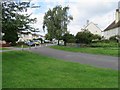
Image Map
Images are licensed for reuse under creativecommons.org/licenses/by-sa/2.0
Notes
- Clicking on the map will re-center to the selected point.
- The higher the marker number, the further away the image location is from the centre of the postcode.
Image Listing (685 Images Found)
Images are licensed for reuse under creativecommons.org/licenses/by-sa/2.0
Image
Details
Distance
1
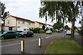
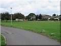
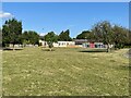
Paget Road
Part of a council estate centred on a large green. The first house here seems to be faced with metal panels.
Image: © Duncan Grey
Taken: 16 Jun 2008
0.02 miles
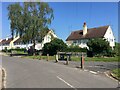
5
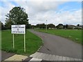
Access to Cambridge Professional Development Centre
Image: © Fernweh
Taken: 19 Aug 2017
0.04 miles
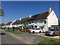
6
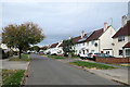
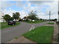
Trumpington: Paget Road
Post-War council-built houses on what was until recent years the southern edge of Cambridge.
Image: © John Sutton
Taken: 30 Sep 2018
0.04 miles