
IMAGES TAKEN NEAR TO
Lime Avenue, CAMBRIDGE, CB2 9DE
Introduction
This page details the photographs taken nearby to Lime Avenue, CB2 9DE by members of the Geograph project.
The Geograph project started in 2005 with the aim of publishing, organising and preserving representative images for every square kilometre of Great Britain, Ireland and the Isle of Man.

There are currently over 7.5m images from over14,400 individuals and you can help contribute to the project by visiting https://www.geograph.org.uk
Image Map
Images are licensed for reuse under creativecommons.org/licenses/by-sa/2.0
Notes
- Clicking on the map will re-center to the selected point.
- The higher the marker number, the further away the image location is from the centre of the postcode.
Image Listing (695 Images Found)
Images are licensed for reuse under creativecommons.org/licenses/by-sa/2.0
Image
Details
Distance
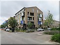
2
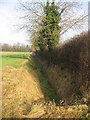
Well kept field ditch
It was good to see that the ditch has been looked after even though the fields either side of the hedge are no longer actively farmed.
Image: © Mr Ignavy
Taken: 28 Dec 2008
0.01 miles
3
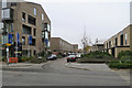
Clay Farm Drive
Part of the incomplete Clay Farm (Great Kneighton) housing development east of Trumpington on the southern edge of Cambridge.
Image: © John Sutton
Taken: 1 Nov 2017
0.01 miles
4
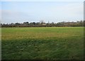
Across the fields to Clay Farm
I originally took this photo knowing that a major housing development was being planned. Sure enough, 6 years later this view and all of the immediate area looks very different. See Image
Image: © Mr Ignavy
Taken: 28 Dec 2008
0.01 miles
5
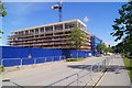
More homes on Lime Avenue
Part of the Clay Farm development. See Image for a view of the field before construction work began.
Image: © Fernweh
Taken: 17 May 2015
0.01 miles
6
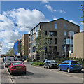
Clay Farm: Lime Avenue and Halo
This is the northern end of the Clay Farm (Great Kneighton) estate, off Long Road. The Halo development's publicists claim it is "a manifesto for modern living", whatever that means. The blocks beyond consist of "109 new homes for rent and shared-ownership sale".
Image: © John Sutton
Taken: 29 Apr 2016
0.01 miles
7
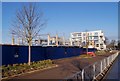
Lime Avenue - the early days
In the background is the Aura building, one of the first parts of the Clay Farm development to be completed and occupied.
This land is greenbelt land and was previously part of Clay Farm which was located just off Long Road.
See Image for how this field looked, 6 years earlier, before the development began.
Image: © Fernweh
Taken: 28 Dec 2014
0.02 miles
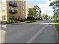
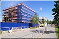
10
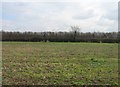
Tree in a hedge
Boundary between two fields on farmland which was once part of Clay Farm. I took this photo to ensure that there was a record of these fields before a potential housing development takes place on the land. It may be a few years yet!
UPDATE: work started in 2013.
Image: © Mr Ignavy
Taken: 19 Feb 2009
0.02 miles